GIS user technology news

News, Business, AI, Technology, IOS, Android, Google, Mobile, GIS, Crypto Currency, Economics

  • Advertising & Sponsored Posts
    • Advertising & Sponsored Posts
    • Submit Press
  • PRESS
    • Submit PR
    • Top Press
    • Business
    • Software
    • Hardware
    • UAV News
    • Mobile Technology
  • FEATURES
    • Around the Web
    • Social Media Features
    • EXPERTS & Guests
    • Tips
    • Infographics
  • Blog
  • Events
  • Shop
  • Tradepubs
  • CAREERS
You are here: Home / * PRESS / Business / Gilytics joins Esri Partner Network Program

Gilytics joins Esri Partner Network Program

January 14, 2022 By GISuser

Gilytics brings Pathfinder, a cloud solution to automate infrastructure, design, planning and routing, into ArcGIS and joins Esri Partner Network Program

Zurich, January 12, 2022. Gilytics, a Swiss based company, which provides Pathfinder – a GIS cloud solution to automate the design, planning and routing of infrastructure – announces it has been accepted into the Esri Partner Network Startup Program. Pathfinder helps clients with a spatial optimization engine to automate manual processes in the design and planning of energy, transportation and telecommunication infrastructure. In addition, the same solution is used for improving and easing the stakeholder engagement and public participation. The integration will provide ArcGIS users with the ability to leverage the Pathfinder solution and a perfect integration of data services and customized technology in the ArcGIS system.

Pathfinder clients include utilities, engineering and energy sector organizations that have also used Esri products, including ArcGIS Pro and ArcGIS Online, in their design and planning processes for decades. This integration will provide a seamless connection with ArcGIS where users will be able to benefit from both technologies.
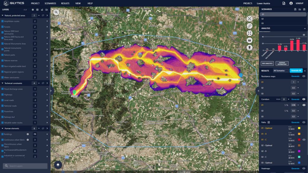
Pathfinder Software Impression – Corridor

About Gilytics
Gilytics delivers a Cloud GIS-based platform and service solution allowing users to calculate alternative routes for powerlines, pipelines, roads, and railways, helping energy, engineering and transport companies save time and CO2 with better data, visuals and communication. Our vision is to become the standard software solution for the planning of linear infrastructure with the potential to expand into asset management and stakeholder engagement. Our mission is to accelerate and make more transparent the clean energy transition. The company is an ETH Spinoff founded in 2017 with clients throughout Europe and the Americas with headquarters in Zurich.
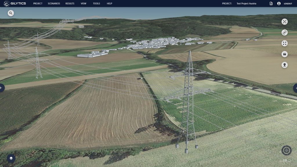
Pathfinder Software Impression – 3D View

Learn More

Filed Under: Business Tagged With: ESRI, partner, startup

Editor’s Picks

Brothers Code is fueling the diverse tech talent pipeline by teaching 250+ young men of color code

#DevSummit Video – A First Look at Drone2Map for ArcGIS

Maps attributed to the 13th-century traveler sketch what looks like the coast of Alaska

Map of the Day – TheCeliacScene, Guides for the Gluten Free

See More Editor's Picks...

Recent Industry News

Increase Rev vs. Google AdSense: Unlocking 50%–200% Higher Earnings

August 17, 2026 By GISuser

From Simulator to Open Air: A Practical Start to FPV Flying Safely

August 14, 2026 By GISuser

Pop-Up Card Wallets vs Traditional Slim Wallets: Which Is Better?

August 11, 2026 By GISuser

Comment les PME et commerçants du Québec optimisent la livraison du dernier kilomètre pour fidéliser leurs clients

August 8, 2026 By GISuser

Hot News

State of Data Science Report – AI and Open Source at Work

HERE and AWS Collaborate on New HERE AI Mapping Solutions

Virtual Surveyor Adds Productivity Tools to Mid-Level Smart Drone Surveying Software Plan

Categories

Copyright gletham Communications 2015 - 2026

Go to mobile version