GIS user technology news

News, Business, AI, Technology, IOS, Android, Google, Mobile, GIS, Crypto Currency, Economics

  • Advertising & Sponsored Posts
    • Advertising & Sponsored Posts
    • Submit Press
  • PRESS
    • Submit PR
    • Top Press
    • Business
    • Software
    • Hardware
    • UAV News
    • Mobile Technology
  • FEATURES
    • Around the Web
    • Social Media Features
    • EXPERTS & Guests
    • Tips
    • Infographics
  • Blog
  • Events
  • Shop
  • Tradepubs
  • CAREERS
You are here: Home / * PRESS / Business / Space Flight Laboratory (SFL) Awarded Norwegian Space Agency Contract to Build NorSat-4 Maritime Tracking Microsatellite

Space Flight Laboratory (SFL) Awarded Norwegian Space Agency Contract to Build NorSat-4 Maritime Tracking Microsatellite

August 9, 2021 By GISuser

TORONTO, Ontario, Canada, 9 August 2021 – The Norwegian Space Agency (NOSA) has awarded a contract to Space Flight Laboratory (SFL) to build the NorSat-4 maritime tracking microsatellite. NorSat-4 will be the eighth satellite developed by SFL for Norway, including NorSat-3 launched in April 2021 and the NorSat Technology Demonstrator (NorSat-TD) now under construction.
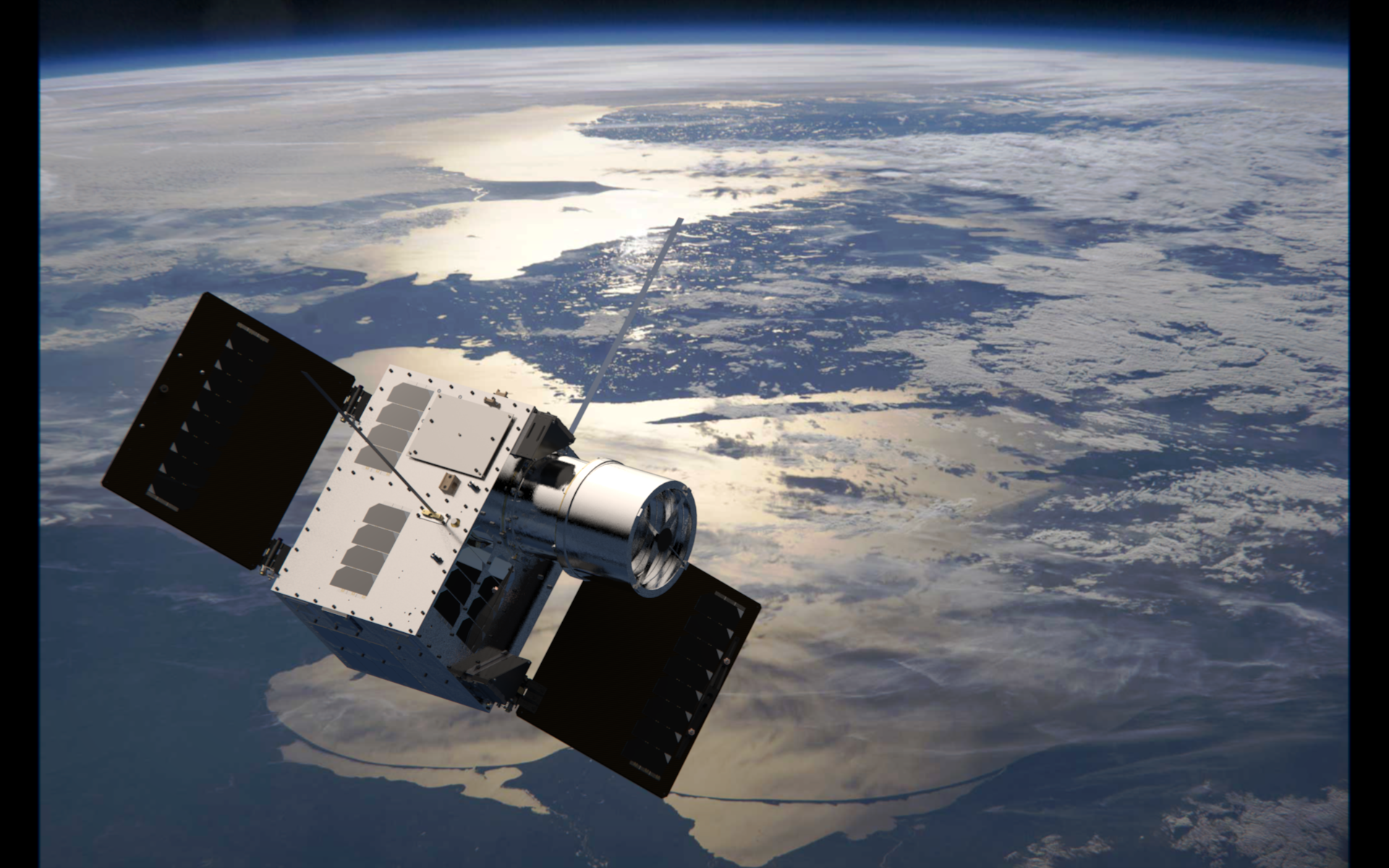
 

Similar to NorSat-1, -2 and -3, NorSat-4 will be built on SFL’s DEFIANT microsatellite platform (a variant of the NEMO platform that uses a separation system and not a dispenser) and carry an Automatic Identification System (AIS) ship tracking receiver developed by Kongsberg Seatex. An important new addition on NorSat-4 will be a low-light imaging camera.

“SFL is pleased to play an integral role in the NorSat program as NOSA continues to innovate as the world leader in space-based maritime traffic monitoring,” said SFL Director Dr. Robert E. Zee.

To develop the miniature low-light imaging camera, the Norwegian Defence Research Establishment (FFI) has contracted Safran Reosc of France. This powerful device will detect vessels larger than 30 meters in length in Arctic waters, which are shrouded by darkness much of the year.

“NOSA is eager to add the capabilities of NorSat-4 to the current fleet of maritime surveillance satellites and to support the demonstration of FFI’s newest technologies and techniques for creating a better understanding of maritime traffic for Norwegian users,” said Microsatellite Program Manager at NOSA, Lene Marthinsen.

SFL has a long history of developing ship-tracking microspace missions for Norway starting with the AISSat-1 nanosatellite launched in 2010. It determined that reception of AIS signals in orbit was indeed feasible. AISSat-1 proved so robust that Norway soon commissioned it as an operational ship-tracking mission. Subsequently, additional AISSats were launched, followed by a new line of higher capacity microsatellites – the NorSats – all developed by SFL with customer-furnished payloads.

SFL is a unique microspace provider that offers a complete suite of nano-, micro- and small satellites – including high-performance, low-cost CubeSats – that satisfy the needs of a broad range of mission types from 3 to 500 kilograms. Dating from 1998, SFL’s heritage of on-orbit successes includes 72 satellites and distinct missions related to Earth observation, atmospheric monitoring, ship tracking, communication, radio frequency (RF) geolocation, technology demonstration, space astronomy, solar physics, space plasma, and other scientific research.

In its 23-year history, SFL has developed CubeSats, nanosatellites, and microsatellites that have achieved more than 150 cumulative years of operation in orbit. These microspace missions have included SFL’s trusted attitude control and, in some cases, formation-flying capabilities. Other core SFL-developed components include modular (scalable) power systems, onboard radios, flight computers, and control software.

About Space Flight Laboratory (SFL) (www.utias-sfl.net)

SFL generates bigger returns from smaller, lower cost satellites. Small satellites built by SFL consistently push the performance envelope and disrupt the traditional cost paradigm. Satellites are built with advanced power systems, stringent attitude control and high-volume data capacity that are striking relative to the budget. SFL arranges launches globally and maintains a mission control center accessing ground stations worldwide. The pioneering and barrier-breaking work of SFL is a key enabler to tomorrow’s cost aggressive satellite constellations. (www.utias-sfl.net)

Filed Under: Business, Earth Imaging - Remote Sensing

Top Press

The Global Expansion of Aueshah: A New Era of High Jewelry

April 11, 2026 By GISuser

KARACHI, PAKISTAN. The international luxury market is experiencing a profound shift. Consumers are increasingly rejecting mass-produced goods in favor of rarity, authenticity, and emotional depth. … [Read More...]

State of Data Science Report – AI and Open Source at Work

September 10, 2025 By GISuser

AI and Open Source at Work … [Read More...]

Topcon Announces Landmark Expansion of Topnet Live Network Across USA

January 26, 2025 By GISuser

LIVERMORE, Calif.---Topcon Positioning Systems has announced a significant expansion of its Topnet Live reference station network, introducing 200 new geodetic stations strategically positioned across … [Read More...]

Space Flight Laboratory (SFL) Announces Launch and Deployment of NorSat-4 Maritime Monitoring Microsatellite

January 19, 2025 By GISuser

Seventh Satellite Developed by SFL for Norway … [Read More...]

HERE and BMW Group extend partnership on AI-powered mapping system

January 8, 2025 By GISuser

HERE and BMW Group extend partnership on AI-powered mapping system for automated driving and enhanced road safety … [Read More...]

Everest Base Camp Helicopter Tour, Helicopter Return Trek, and Manaslu Circuit Trek: Which Nepal Adventure Is Right for You?

November 6, 2026 By GISuser

Almost everyone planning a Nepal trip runs into the same wall. You want the big mountains, you have a fixed number of days, and every itinerary you read seems to promise something … [Read More...]

SFL Missions Inc. Confirms Successful Deployment of Six HawkEye 360 Radio Frequency Detection Satellites with Advanced Capabilities

October 27, 2026 By GISuser

MĀHIA, New Zealand, 26 October 2026 – SFL Missions Inc. today confirmed the successful deployment of six radio frequency (RF) detection and geolocation satellites for HawkEye 360 … [Read More...]

Canadian-Built RoadEng 12 Uses AI to Find the Best Location for New Resource and Rural Roads

October 17, 2026 By GISuser

Vancouver, BC, Canada, October 15, 2026 – North Vancouver-based Softree Technical Systems today released RoadEng Version 12, used in more than 75 countries to locate and design … [Read More...]

Beyond the Map: How AI Image and Video Generation Is Changing Geospatial Communication

October 14, 2026 By GISuser

Ask anyone who has shipped a GIS project what the hardest part was, and the answer is rarely the spatial analysis. It is almost always the communication. A site suitability … [Read More...]

From Maternity to Everyday Wear: Building a Wardrobe That Grows With You

October 14, 2026 By GISuser

When I think about maternity clothing, I feel the biggest mistake is buying too many things at once. During pregnancy, your body keeps changing, and something that fits well today … [Read More...]

Copyright gletham Communications 2015 - 2026

Go to mobile version