A course that teaches GIS cloud architecture
A primary financial driver of cities and counties is property taxes. A central map of parcels and ownership is used by a tax assessor as well as queried by the public, commercial developers, and real estate appraisers.
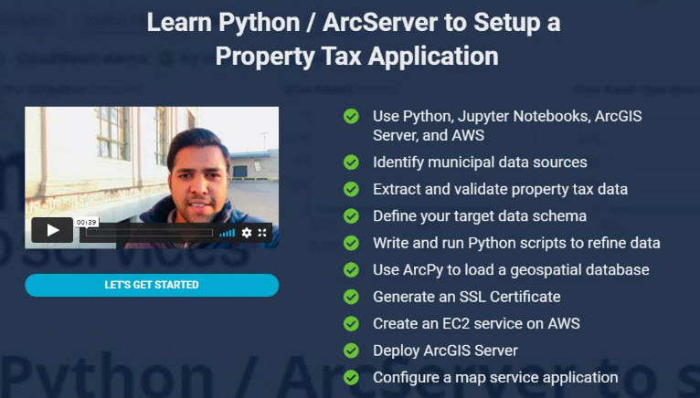
An essential skillset is the ability to leverage Python to manipulate county wide data parcel attributes and serve the data spatially via the web. This course will show you how to extract, transfer, and load (ETL) spatial data through a Python Data workflow. Going further, you will set up an ArcGIS Server application to host this data in AWS for public query and give you a string of competitive skillsets that every city and county needs. This course is listed on the new GIS education platform, Bootcamp GIS. A growing library of courses are being taught by Subject Matter Experts that demonstrate their real projects through online short courses. The platform gives students the flexibility to pick a single course, build a certificate, start classes when they want, and choose tiers of instructor interaction. See How it Works.
A course that teaches GIS cloud architecture
The need for GIS and IT skills
To analyze, visualize, and serve GIS data, an analyst increasingly needs IT skills. Many of us learned standard GIS data collection, data structures, and analysis techniques. But to be relevant, you now need to know much more. So it makes sense that Imtiaz Syed, the course author, saw the opportunity of creating a course that really focused on the GIS/IT blend which is what he does as a former Esri developer and now private GIS contractor to Google. Syed said, ‘Python is an essential skill to handle daily data problems. And if you are going to leverage your data for mass consumption, then knowing cloud architecture like AWS is a must.’ These skills allow you to work on scalable applications for medium and large organizations.
The GIS Architect
GIS and IT have formed the field of GIS Science and produces the coveted GIS architect. Having a solid IT background is a competitive advantage. Syed confirmed this by saying ‘My Masters in GIS Technology was not enough. Once I really dived into cloud architecture to serve GIS data, my opportunities flourished.’ If you want to prioritize your learning, you can gain skills through AWS, GCP, and Azure. And these technologies are utilized in these top ranked GIS Science programs.
Visit www.bootcampgis.com to see about registering for a course. Anyone seeking opportunities to author a course or having a corporate HR partnership then please email: support@bootcampgis.com.
About Bootcamp GIS:
Bootcamp GIS is a geospatial education platform serving courses taught by subject matter experts. The platform helps students overcome their academic skills gaps or stay relevant with constantly evolving technology. All short courses are based on real industry projects which make students more marketable and more adept at architecting enterprise implementations.
LinkedIn: https://www.linkedin.com/company/bootcamp-gis
Facebook: https://www.facebook.com/BootcampGIS/
YouTube: https://www.youtube.com/channel/UC43qkcwiZoEd3VKL3He1c_Q
Keywords: GIS certificate, online GIS training, online certificate in GIS, career in GIS, learn ArcGIS, jobs in GIS, degree in GIS, Cloud architecture, GIS application development