GIS user technology news

News, Business, AI, Technology, IOS, Android, Google, Mobile, GIS, Crypto Currency, Economics

  • Advertising & Sponsored Posts
    • Advertising & Sponsored Posts
    • Submit Press
  • PRESS
    • Submit PR
    • Top Press
    • Business
    • Software
    • Hardware
    • UAV News
    • Mobile Technology
  • FEATURES
    • Around the Web
    • Social Media Features
    • EXPERTS & Guests
    • Tips
    • Infographics
  • Blog
  • Events
  • Shop
  • Tradepubs
  • CAREERS
You are here: Home / * PRESS / Business / BigData Earth Develops New Location Profile Report for Worldwide Agricultural Land

BigData Earth Develops New Location Profile Report for Worldwide Agricultural Land

December 5, 2016 By GISuser

5 December 2016 – Modern Earth observation technologies (spaceborne, airborne and terrestrial) are increasingly deployed to capture environmental attributes about agricultural land and assets. Big data collected by various sensors and the information extracted are critical for the growing AgTech and precision agriculture industry.

Many baseline terrain and environmental attributes for agricultural land should be systematically and digitally catalogued in the first place. BigData Earth develops new location profile reports for worldwide agricultural land, by including the following site-specific components:

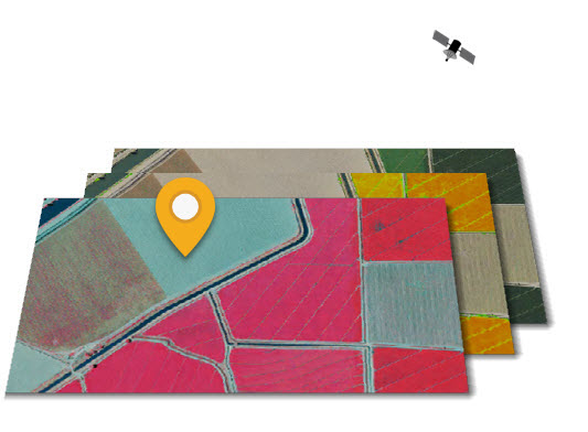
  • Natural colour, colour-infrared, and NDVI imagery

  • Terrain profiles and topographic variations

  • Vegetation cover

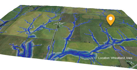
  • Drainage delineation and wet-areas mapping, an aspect that is highly related to the evaluation of physical and chemical properties of agricultural soils, including soil moisture content, soil particle composition and soil types.

  • Climate-warming trends on max and min temperatures, an aspect that concerns many farmers and impacts the suitability and productivity of arable land in the long term.
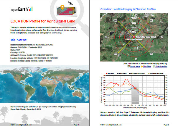
The new integrated location profile report (typically in PDF format) goes beyond common imagery and basemaps, and contains a wide range of metrics and insights supporting informed location decisions.

For the contiguous U.S., more detailed reports are also being developed using 1m-resolution aerial imagery and 10m-/3m-/1m-resolution elevation data from the U.S. government agencies.

Reports can be readily produced with an efficient mapping and analytical system. A popular application scenario is that a large portfolio of agricultural lands need to be quickly analysed in order to obtain both the big picture and detailed reports of individual sites.

Samples are available at BigData Earth website http://www.bigdataearth.com/

Save

Filed Under: Business, Environment, Top Press Tagged With: BigData Earth

Editor’s Picks

Wider Selection of US Topo Maps From USGS Now Available in Avenza’s PDF Maps App

Global Earthquake Numbers on Par for 2015

ArcGIS 10.3 and ArcGIS Pro Now Available – Modernize GIS for Organizations and Enterprises

Web GIS Gets A Huge Boost From Esri – What’s New in ArcGIS 10.3

See More Editor's Picks...

Recent Industry News

Bird Netting Installation in Dubai for Property Care 

July 11, 2026 By GISuser

How AI Helps Identify Crystals From Photos

July 10, 2026 By GISuser

The Future of Competitive Gaming: Why DMA Technology is the Ultimate Performance Edge

June 24, 2026 By GISuser

Milwaukee M18FHZ-0 Hackzall Reciprocating Saw – For hardcore cutting in a compact size

June 19, 2026 By GISuser

Hot News

State of Data Science Report – AI and Open Source at Work

HERE and AWS Collaborate on New HERE AI Mapping Solutions

Virtual Surveyor Adds Productivity Tools to Mid-Level Smart Drone Surveying Software Plan

Categories

Copyright gletham Communications 2015 - 2026

Go to mobile version