GIS user technology news

News, Business, AI, Technology, IOS, Android, Google, Mobile, GIS, Crypto Currency, Economics

  • Advertising & Sponsored Posts
    • Advertising & Sponsored Posts
    • Submit Press
  • PRESS
    • Submit PR
    • Top Press
    • Business
    • Software
    • Hardware
    • UAV News
    • Mobile Technology
  • FEATURES
    • Around the Web
    • Social Media Features
    • EXPERTS & Guests
    • Tips
    • Infographics
  • Blog
  • Events
  • Shop
  • Tradepubs
  • CAREERS
You are here: Home / * PRESS / Business / OpenRouteService 3.3 is going Mobile – Routing in the Americas, Gradients and more!

OpenRouteService 3.3 is going Mobile – Routing in the Americas, Gradients and more!

June 28, 2016 By Editor

In our latest release we have primarily focused on optimising and stabilising the backend and on adding new elements to provide an improved user experience throughout the OpenRouteService 3.3 based on OpenStreetMap data.

After many requests from our community, we for starters can happily announce that we have made the service responsive for your mobile smartphones. You are now able to compute your routes when you are on the go.
Furthermore we have changed the styles and layout of the service to ultimately bring the user experience to the next level. Amongst these updates we are happily to feature:

  • A new route summary, now also comprising ascent and descent information for outdoor profiles
  • The possibility to download GPX files containing elevation information provided by the service
  • A more intuitive options menu giving you the option to parameterise your route preferenes
  • Several tooltips informing you with hints for the specific buttons

Please feel free to send us any kind of feedback with suggestions or improvements.
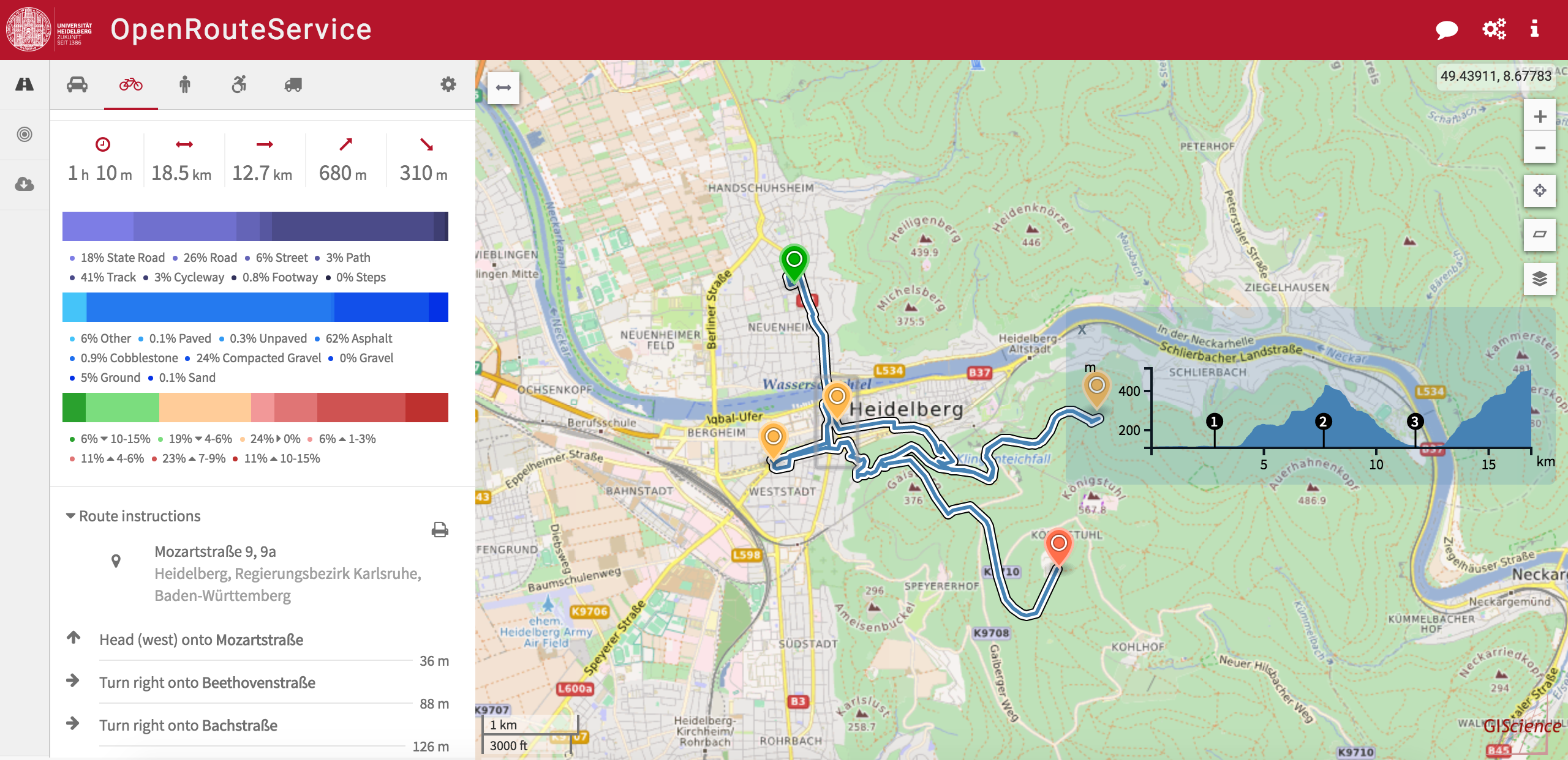
Additionally we have been working on several novel features for all of you outdoor lovers. As you have noticed in our last update we added height information in form of an elevation profile for the bicycle, pedestrian and wheelchair profile. We now actually started to crunch this information to ultimately derive ascent and descent values along the route. By doing so we created a new horizontal chart comprising the specific gradients and its percentages which can be hovered and seen in the map accordingly. As also requested by the ORS community we added via points along the route into the elevation profile to increase the readability.

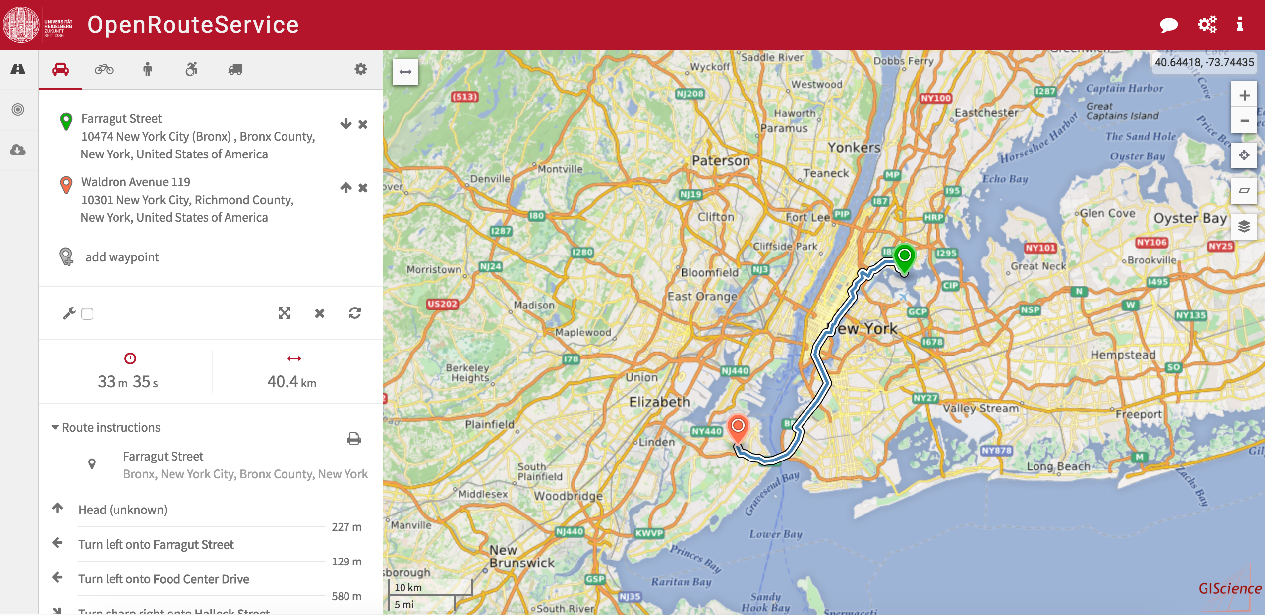
And of course we have been improving the stability of the service. In the course of this we upgraded our backend with additional storage which gives us means to offer you car routing capabilities for North and South America.
Happy Routing!

Links:

  • ORS Issues on GitHub.com
  • OpenRouteService.org
  • Contact us

Filed Under: Business, Mobile Tagged With: OpenRouteService

Editor’s Picks

Learn to Make Decisions Using Lidar Data and Geographic Information Systems

Panasonic Toughbook 54 Sets New Standard for Semi-Rugged Laptops

Global Earthquake Numbers on Par for 2015

First Look – Los Angeles Opens the GeoHub – #OpenData for Citizens and Developers

See More Editor's Picks...

About Editor

Glenn is a geographer and a GIS professional with over 20 years experience in the industry. He's the co-founder of GISuser and several other technology web publications.

Recent Industry News

Furnace Repair: Fast Fixes for a Warm, Worry-Free Home

September 15, 2026 By GISuser

Aerial Surveys International Awarded GSA Multiple Award Schedule Contract

September 12, 2026 By GISuser

New Episode Alert: The Colorado State University (CSU) Drone Center

September 10, 2026 By GISuser

Increase Rev vs. Google AdSense: Unlocking 50%–200% Higher Earnings

August 17, 2026 By GISuser

Hot News

State of Data Science Report – AI and Open Source at Work

HERE and AWS Collaborate on New HERE AI Mapping Solutions

Virtual Surveyor Adds Productivity Tools to Mid-Level Smart Drone Surveying Software Plan

Categories

Copyright gletham Communications 2015 - 2026

Go to mobile version