Signs Strategic Agreement with Chinese Government to Share Data with Users around the World
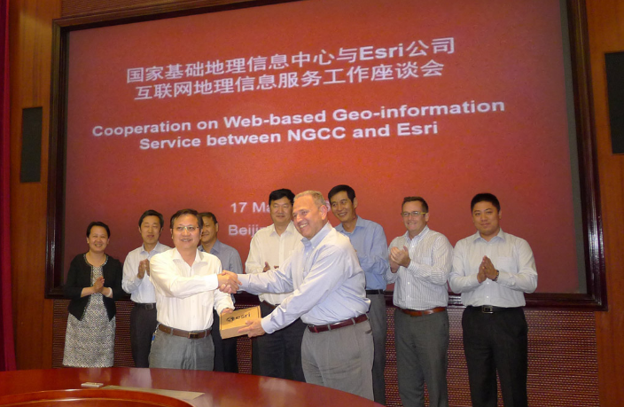
Dean Angelides, director, International Operations, Esri, and Feng Xianquang, director for NGCC, signed the historic agreement to share data with users around the world.
Redlands, California—June 14, 2016—The world’s leading mapping platform company, Esri, and the National Geomatics Center of China (NGCC) held a signing ceremony in Beijing, China with respect to providing access to NGCC’s mapping web services. This historic agreement will allow more users who reside outside of China to access the country’s authoritative cartographic and imagery data. Users of the Esri ArcGIS platform will have access to the maps for no additional charge.
“The cooperation between NGCC and Esri will enable a large number of ArcGIS online users to gain access to the rich regional online geodata of China,” said Zhigang Li, NASG Chief Engineer, on behalf of NASG. “The agreement will facilitate the scientific and technological communication between agencies by sharing geographic information and services over the web in the Asia Pacific Region. NGCC hopes this joint work is able to promote regional, even global, promotion of spatial data.”
NGCC is a government agency attached to National Administration of Surveying, Mapping (NASG) and Geoinformation of China. NGCC is responsible for national data that is used in surveying and mapping projects in China, as well as facilitating the scientific and technological communication between agencies in China, in the areas of sharing geographic data and services over the web.
“We are honored to work with the government of China to provide access to the most current and authoritative basemaps for the country,” said Jack Dangermond, president of Esri. “We look foreward to continued collaboration.”
The web services will be available in the third quarter of 2016. For more information on content available for the ArcGIS platform visithttp://www.esri.com/data.
# # #
Since 1969, Esri has been giving customers around the world the power to think and plan geographically. As the market leader in GIS, Esri software is used in more than 350,000 organizations worldwide including each of the 200 largest cities in the United States, most national governments, more than two-thirds of Fortune 500 companies, and more than 7,000 colleges and universities. Esri applications, running on more than one million desktops and thousands of Web and enterprise servers, provide the backbone for the world’s mapping and spatial analysis. Esri is the only vendor that provides complete technical solutions for desktop, mobile, server, and Internet platforms. Visit us at www.esri.com.
Esri, the Esri globe logo, GIS by Esri, ArcGIS, www.esri.com, and @esri.com are trademarks, registered trademarks, or service marks of Esri in the United States, the European Community, or certain other jurisdictions. Other companies and products mentioned herein may be trademarks or registered trademarks of their respective trademark owners.