World-first ADD-f(x)™ modular design for matching tablet function to user requirements
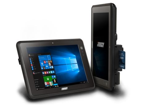
iRUGGY G10 Mobile Tablet (Photo: Business Wire)
TAIPEI, Taiwan–iRuggy Systems Co., Ltd, today announces their next generation iRUGGY G10 10” Mobile Tablet, the world’s first tablet to feature a modular design for user configurability through mix-and-match ADD-f(x) function modules and will be showcasing the tablet at Computex 2016. iRuggy Systems makes rugged systems purpose-built for heavy-use environments including retail, hospitality, warehousing and field services.
“We engineered the iRUGGY G10 to be versatile”
“We engineered the iRUGGY G10 to be versatile,” according to Mark Wallace, iRuggy executive vice-president. “The ADD-f(x) modular design allows us to continue expanding the suite of vertical applications supported and offers a future upgrade path for our customers.” First out ADD-f(x) module options include a 1D/2D scanner, biometric fingerprint reader, RFID, encrypted MSR and EMV-certified smart card reader.
In retail and hospitality, the iRUGGY G10 Mobile Tablet provides users more options for accepting mobile and card payment at the point of service, with clever on-tablet integration of multiple vendor mPOS devices from Verifone, Ingenico, PAX and Miura. Another innovation, a unique Tab2D™ mount instantly converts the G10 Mobile Tablet into a customer display while charging and connected to the VGA customer display port on any legacy POS terminal, without requiring any change to software running on tablet or POS.
The iRUGGY G10 supports field operation with 3G data, dedicated GPS and a hot swappable battery for up to 9 hours use. With in4Touch™ touch mode selection, the user can quickly toggle between input methods including Glove or Stylus to suit environment and application.
Standard system specifications:
- Intel® Atom™ Z3735F Quad-Core, Windows 10 IoT
- IP65 liquid and dust protection, 4 foot drop tested
- 2MP webcam, 5MP AF rear camera with flash
- Wi-Fi 802.11ac, Bluetooth 4.0, NFC contactless reader
- On-board I/O: 2x USB, HDMI, micro SD slot, audio
About iRuggy Systems Company, Ltd
iRuggy Systems is a member of the Flytech Group, one of the world’s top three POS makers, launched as a new venture to serve a growing market for ruggedized tablet and handheld terminals. iRuggy is led by an experienced team with over 20 years in POS and rugged HW systems design and manufacture. Learn more about iRUGGY at www.iruggy.com