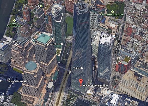
New York and San Francisco are the first cities to have got a 3D makeover, with more following next year
Google Maps 3D goes super hi-res
This from MailOne UK…
From undulating sand dunes to the Great Barrier Reef, Google has added some of the world’s most spectacular sights to its Street View library over the past year.
Now, it has updated some 3D models in Google Earth, including the Statue of Liberty and bay Bridge in San Francisco.
The attention to details is incredible, with thousands of tiny windows on skyscrapers showing ‘reflections’ and features demonstrating the texture of monuments.
- New York and San Francisco are the first cities to have got a 3D makeover, with more following next year
- Viewers can take a tour of the cities in 3D via Google Earth, or Earth View in Google Maps
- Updated landmarks include the Freedom Tower and Statue of Liberty in New York and Bay Bridge in San Francisco
Read more:
Follow: @MailOnline on Twitter | DailyMail on Facebook