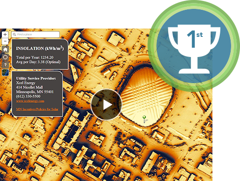
Just one day in to the esriuc and there’s already tons to absorb! Day 1 was all about the plenary session and the state of ArcGIS. Jack Dangermond was the focus of the morning, however, he did share the stage with some of his favorite customers and let them have free run to describe how ArcGIS and Esri technology is helping them solve their problems and better understand the World around them. I was particularly blown away with the GIS crew from the city of Minneapolis who have been whittled down to a skeleton crew of 3 due to the recession, however, that hasn’t stopped them from working harder and smarter and doing some amazing things – obviously ArcGIS is helping them to leverage their enterprise Geo data to the point that they earned an invite to the conference main stage. The team shared details of their solar panel suitability app that enables them to model the city and identify the most suitable locations for solar panels. They also shared details of their tree asset inventory and snow removal management system – both systems saving the city loads of time and money.

Esri user conference (Image credit: Esri)
There was plenty of hype and loads of applause for Dangermond and team during the day – the following are just a few of the hot topics, themes and buzz words that I picked up on during the day:
- According to Jack, GIS is now at a point where it is reaching its full potential
- Geography is now more important than ever, providing a framework for understanding our World
- Dangermond wants us all to be GeoDesigners!
- Data is the heart and soul of GIS
- ArcGIS online is the living atlas – already more than 2 million maps have been shared
- Driving it all has been the proliferation of crowd sourcing, big data support, and advanced modeling tools
- Of interest, Esri will be rolling out a MOOC soon, hoping to help educate 50,000 people of geodesign
- Opendata is opening a world of opportunities
My day wrapped up with a special meeting where the guests were the developers responsible for the creation of the winning apps in the recent Climate resilience app challenge – some great minds solving some of the World’s issues thanks to tools provided by Esri – see details of all the winning apps HERE
Be sure to follow all the updates from the event on Twitter hashtag #esriuc