GIS user technology news

News, Business, AI, Technology, IOS, Android, Google, Mobile, GIS, Crypto Currency, Economics

  • Advertising & Sponsored Posts
    • Advertising & Sponsored Posts
    • Submit Press
  • PRESS
    • Submit PR
    • Top Press
    • Business
    • Software
    • Hardware
    • UAV News
    • Mobile Technology
  • FEATURES
    • Around the Web
    • Social Media Features
    • EXPERTS & Guests
    • Tips
    • Infographics
  • Blog
  • Events
  • Shop
  • Tradepubs
  • CAREERS
You are here: Home / News / GIS, Geo Tech Software / DrCOG And Way To Go Unveil First Of Its Kind Trip Planning tool

DrCOG And Way To Go Unveil First Of Its Kind Trip Planning tool

January 30, 2014 By Editor

DRCOG AND WAY TO GO UNVEIL FIRST-OF-ITS-KIND TRIP PLANNING TOOL – Region’s Commuters Benefit

Jan. 28, 2014 (Denver, Colorado) — Traffic congestion, travel delays and air pollution all point to a problem the Denver metro area and its commuters face daily. My Way to Go, an innovative web-based trip planning tool launched this week at mywaytogo.org, offering area residents a convenient central resource to explore multiple commute options. The Denver Regional Council of Governments (DRCOG) Way to Go program debuts the one-stop shop that allows commuters to easily and comprehensively compare their trip options and make informed choices.

Users can simply enter their trip information to quickly see their commute options and compare travel time, distance, cost, and health benefits, including calories burned and such environmental impacts as CO2 generated. The tool incorporates transit (including bus and light rail), biking, walking, carpooling and vanpooling, comparing each option to driving alone. DRCOG and its partners hope to incorporate even more features, including carshare and bikeshare information, in a later phase of development. “This tool is really the first of its kind in the country, comparing different aspects of commute information on multiple modes in just a few quick and easy steps,” said DRCOG Executive Director Jennifer Schaufele. “It offers Denver region commuters the best available multimodal trip planning experience. We believe this will be a game-changer as we work to shift commuting behavior and meet our Metro Vision traffic goals.”

DRCOG pioneered ridematching services in the region in the 1970s as a response to the energy crisis using a time-intensive manual tracking system to form

carpools. And while the underlying technologies have changed over the years to computer-based systems, the offerings still fell short of the experience the Way to Go team envisioned.
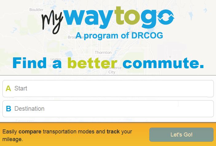
drCOG myway to go

“Market research indicates that one of the key barriers for people even considering other options is the difficulty in finding good information. Visiting multiple websites to explore options, calculate costs and incorporate other variables makes it more work than people think it’s worth,” said Schaufele. “We’re removing that barrier.”

The My Way to Go tool has been developed by California-based RideAmigos, working closely with Way to Go staff and mapping technology leader Esri to design the best possible user experience. The interactive website is easy to use and offers mobile interface on smartphones and tablets without requiring an app. The platform sets a new standard in the industry, one that could become a model for other agencies to follow.

Commuters can start exploring their options at www.mywaytogo.org; businesses can ask for a demonstration from a Way to Go specialist (303-458-7665 begin_of_the_skype_highlighting 303-458-7665 FREE  end_of_the_skype_highlighting) to see how they can help their employees use the new tool.

# # #

The Denver Regional Council of Governments is a nonprofit collaborative association governed by a Board of Directors representing 56 county and municipal governments. Board members work together to make life better in the Denver region for people of all ages, incomes and abilities. Through Metro Vision, the plan to manage growth over the next 25 years, the region’s local governments work cooperatively to address development, land use, transportation, environmental quality and older adult issues.


Filed Under: GIS, Geo Tech Software Tagged With: DrCOG And Way To Go Unveil First Of Its Kind Trip Planning tool, Geo Tech Software, GIS, News

About Editor

Glenn is a geographer and a GIS professional with over 20 years experience in the industry. He's the co-founder of GISuser and several other technology web publications.

Top Press

The Global Expansion of Aueshah: A New Era of High Jewelry

April 11, 2026 By GISuser

KARACHI, PAKISTAN. The international luxury market is experiencing a profound shift. Consumers are increasingly rejecting mass-produced goods in favor of rarity, authenticity, and emotional depth. … [Read More...]

State of Data Science Report – AI and Open Source at Work

September 10, 2025 By GISuser

AI and Open Source at Work … [Read More...]

Topcon Announces Landmark Expansion of Topnet Live Network Across USA

January 26, 2025 By GISuser

LIVERMORE, Calif.---Topcon Positioning Systems has announced a significant expansion of its Topnet Live reference station network, introducing 200 new geodetic stations strategically positioned across … [Read More...]

Space Flight Laboratory (SFL) Announces Launch and Deployment of NorSat-4 Maritime Monitoring Microsatellite

January 19, 2025 By GISuser

Seventh Satellite Developed by SFL for Norway … [Read More...]

HERE and BMW Group extend partnership on AI-powered mapping system

January 8, 2025 By GISuser

HERE and BMW Group extend partnership on AI-powered mapping system for automated driving and enhanced road safety … [Read More...]

Everest Base Camp Helicopter Tour, Helicopter Return Trek, and Manaslu Circuit Trek: Which Nepal Adventure Is Right for You?

November 6, 2026 By GISuser

Almost everyone planning a Nepal trip runs into the same wall. You want the big mountains, you have a fixed number of days, and every itinerary you read seems to promise something … [Read More...]

SFL Missions Inc. Confirms Successful Deployment of Six HawkEye 360 Radio Frequency Detection Satellites with Advanced Capabilities

October 27, 2026 By GISuser

MĀHIA, New Zealand, 26 October 2026 – SFL Missions Inc. today confirmed the successful deployment of six radio frequency (RF) detection and geolocation satellites for HawkEye 360 … [Read More...]

Canadian-Built RoadEng 12 Uses AI to Find the Best Location for New Resource and Rural Roads

October 17, 2026 By GISuser

Vancouver, BC, Canada, October 15, 2026 – North Vancouver-based Softree Technical Systems today released RoadEng Version 12, used in more than 75 countries to locate and design … [Read More...]

Beyond the Map: How AI Image and Video Generation Is Changing Geospatial Communication

October 14, 2026 By GISuser

Ask anyone who has shipped a GIS project what the hardest part was, and the answer is rarely the spatial analysis. It is almost always the communication. A site suitability … [Read More...]

From Maternity to Everyday Wear: Building a Wardrobe That Grows With You

October 14, 2026 By GISuser

When I think about maternity clothing, I feel the biggest mistake is buying too many things at once. During pregnancy, your body keeps changing, and something that fits well today … [Read More...]

Copyright gletham Communications 2015 - 2026

Go to mobile version