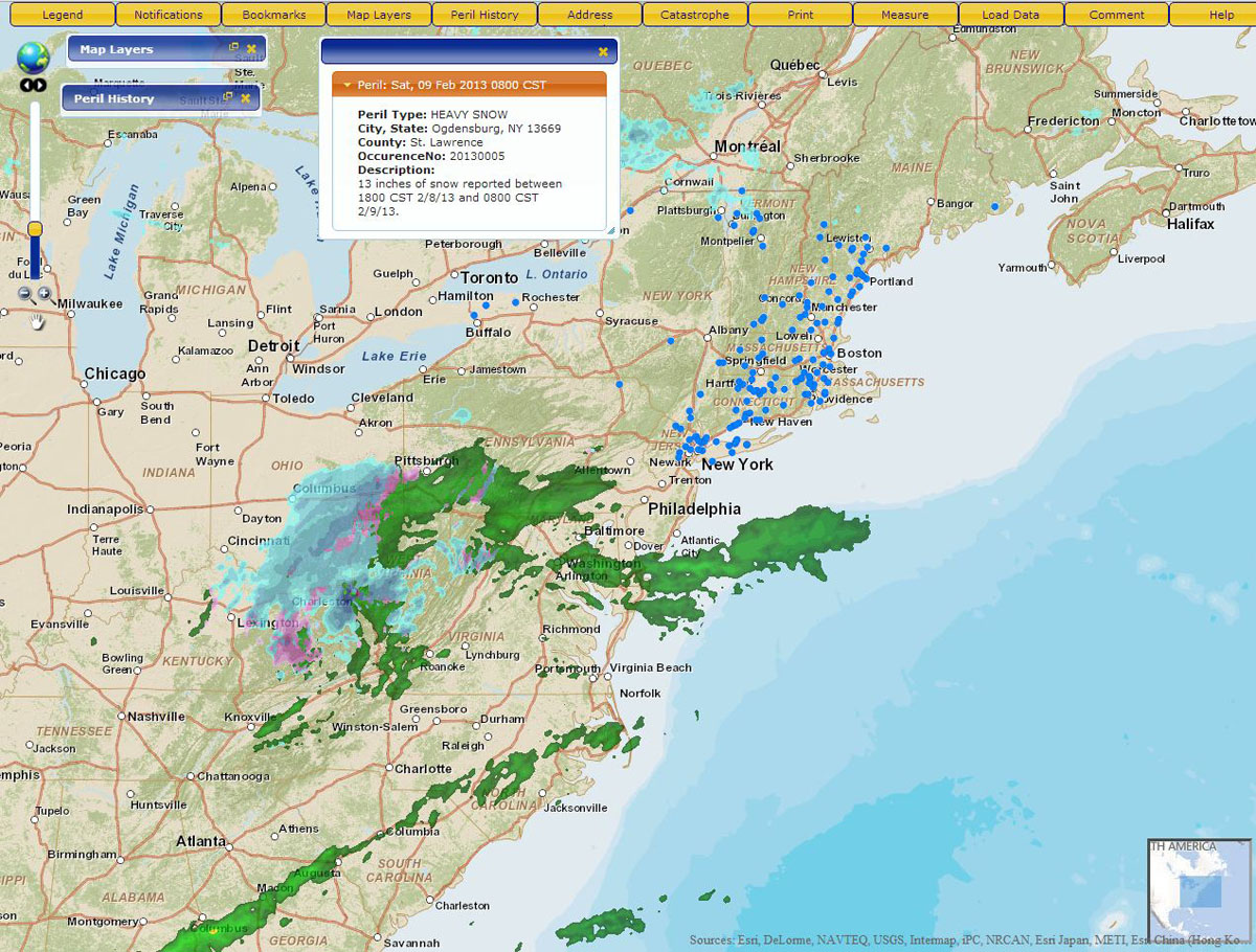
Claims Adjusters Can View Maps with Real-Time Weather Information on Mobile Devices
Redlands, California—March 26, 2013—Esri announces that the Catastrophe Services Department of the Property Loss Research Bureau (PLRB) has released a mobile version of PLRB Map, a mapping service that provides real-time severe occurrence data and information to members of PLRB, an association of 900 property and casualty insurance companies. Esri Gold Tier partner GeoDecisions created this new service on the Esri ArcGIS platform. The service provides improved access to interactive maps across member organizations, from mobile workers to analysts in the central office.
"PLRB has employed Esri mapping technology for two decades," said Hugh Strawn, vice president of PLRB’s Catastrophe Services. "It forms the core of our Catastrophe Services Department products and services that we provide 24/7 for the member companies."
Using the ArcGIS platform has permitted PLRB to leverage the distribution of real-time, as well as historical, data to members’ claims departments. The interactive PLRB Map service helps move critical research functions from the adjuster’s desktop to the mobile device. "It enhances the efficiency of the adjuster in the field by pulling in relevant information, ranging from address-specific PLRB data files to post-catastrophe satellite images, through the power of GIS technology," Strawn said.
The new PLRB Map provides members with a daily map service detailing severe weather, seismic, and technological occurrences that are likely to generate catastrophe claims for member company insurers. Having access to the location of these incidents can help insurers understand potential claims exposure following the events.
"A portfolio’s location and how a pending storm system, for example, may affect it are critical information," Brian J. Smith, GeoDecisions’ director of commercial solutions, said. "Providing this service through PLRB Map helps [PLRB] members understand this information quickly and use it in the field as a real competitive advantage."
The latest PLRB Map incorporates Esri’s ArcGIS Online that allows organizations to create interactive maps and apps and easily share them with others. Incorporating this solution makes it easy for PLRB to provide the detailed information its members need to make the best decisions during the claims management process and ultimately deliver great customer service.
"We are pleased to work with industry leaders like PLRB. Our partnership with GeoDecisions has helped deliver the best technology possible to this outstanding organization. Using Esri technology, they have access to so much more data, which helps them shorten the time it takes to get people back on their feet," said Mark McCoy, insurance solution manager at Esri.
For more information on how Esri helps insurers understand the importance of location, visit esri.com/insurance.
# # #
Since 1969, Esri has been giving customers around the world the power to think and plan geographically. The market leader in GIS, Esri software is used in more than 300,000 organizations worldwide including each of the 200 largest cities in the United States, most national governments, more than two-thirds of Fortune 500 companies, and more than 7,000 colleges and universities. Esri applications, running on more than one million desktops and thousands of Web and enterprise servers, provide the backbone for the world’s mapping and spatial analysis. Esri is the only vendor that provides complete technical solutions for desktop, mobile, server, and Internet platforms. Visit us at www.esri.com.
Esri, the Esri globe logo, GIS by Esri, ArcGIS, www.esri.com, and @esri.com are trademarks, registered trademarks, or service marks of Esri in the United States, the European Community, or certain other jurisdictions. Other companies and products mentioned herein may be trademarks or registered trademarks of their respective trademark owners.
