GIS user technology news

News, Business, AI, Technology, IOS, Android, Google, Mobile, GIS, Crypto Currency, Economics

  • Advertising & Sponsored Posts
    • Advertising & Sponsored Posts
    • Submit Press
  • PRESS
    • Submit PR
    • Top Press
    • Business
    • Software
    • Hardware
    • UAV News
    • Mobile Technology
  • FEATURES
    • Around the Web
    • Social Media Features
    • EXPERTS & Guests
    • Tips
    • Infographics
  • Blog
  • Events
  • Shop
  • Tradepubs
  • CAREERS
You are here: Home / education / A whirlwind week at esriuc

A whirlwind week at esriuc

July 31, 2012 By Editor

My week at the esriuc – You really can’t blame me for being a little tired still – I’m sure a few of you are as well! There was simply sooo much to see, hear, and do at UC 20212! My choice when at the conference is to soak up as much as I can, typically being in the convention center from 7:30 till about 6-ish or longer (a couple of nights lasted till 9).
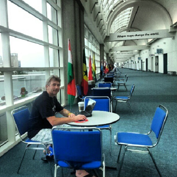
I didn’t manage to catch nearly enough presentations, however, Esri will be making much of the material available online in the near future (oh, just noticed the proceedings are up!) and there are a number of ways to catch up, such as via slideshare, the #esriuc hashtag (very valuable), and through other social channels and sharing vehicles. I have to say kudos and congrats to all the Esri staffers for putting on another fabulous event – FYI, reports have it that there were actually over 16,000 folks registered this year! When I wasn’t in session hearing about ArcGIS 10.1, ArcGIS Online, Mobile technology and the Cloud, I was on the hall floor attempting to meet up with everyone that was exhibiting – no small feat! I did shoot a number of on-site videos and still have plenty of notes and updates to share. For example, I’ll be sharing Q&A’s and cool technology like the Zeno 5 mobile collection unit from Leica; a wicked UAS data collection unit from gatewing (Trimble); a detailed look at GeoJot mobile data collection on iOS and Android; the MobileMapper 10 device; and some really cool hardware from HP. I think I have about 35 videos to edit in todal! Wednesday was a particularly good/long day as the evening provided us with ESRIUC DevMeetUp a couple of hours with the EDN team and some kick-ass developers sharing their tips and tricks. EDN also put together a lightning talks session as well – kudos to the hardworking team, they really stepped it up this year! Finally, for the first time in 14 years I got the FULL conference experience and stayed through Friday, allowing me time to catch the closing session with Jack and crew. It was awesome hearing from all the execs and getting details of why they decided on a career in geography with Esri. I did find the Q&A was a little too planned, most questions being pre-screened and filmed and only several being taken from the floor – not nearly enough. Otherwise, a truly invigorating week!

Note, I was busy Tweeting on the #esriuc all week long and you can catch my entire UC hashtag history stream HERE

  • See our esriuc videos here
  • See our esriuc photo galleries
  • esriuc news and articles archive here

News announcements from ESRIUC

  • Esri and DigitalGlobe Sign Multi-Year Agreement
  • Esri Joins World Ocean Council
  • City of Huber Heights and GTG Receives Special Achievement Award
  • B.C Receives Special Achievement Award for Exceptional Application of Geospatial Technology
  • Europa Technologies takes flight with new release of global data product suite
  • SAG Awards at Esri UC Honor Outstanding Applications of Geospatial Technology
  • Esri Presents Honolulu Mayor Peter Carlisle with Making a Difference Award
  • Esri and Microsoft to Provide Online Maps and Applications during Disasters
  • Esri Maps for Office Extends Location Analytics throughout Organizations
  • New Advancements in Location Intelligence for Businesses and Communities as Esri Chooses NAVTEQ Maps
  • Esri Bolsters Mobile Offerings with Addition of Maptel
  • Expert Feature – Change the World: The Esri GIS Education Conference (by @josephkerski)
  • Blue Marble User Group Meeting at ESRI User Conference in San Diego, CA
  • 2012 San Diego Gaslamp Map – Best Places to Eat and Drink in the Gaslamp for #esriuc
  • Trimble Expands its Positions Software to Streamline Esri Workflows for Mapping and GIS Applications
  • Exelis to showcase image analysis solutions for desktop, cloud and mobile GIS at 2012 ESRIUC
  • DeLorme Introduces ArcSync

Filed Under: education, ESRI, esri uc, events

About Editor

Glenn is a geographer and a GIS professional with over 20 years experience in the industry. He's the co-founder of GISuser and several other technology web publications.

Top Press

The Global Expansion of Aueshah: A New Era of High Jewelry

April 11, 2026 By GISuser

KARACHI, PAKISTAN. The international luxury market is experiencing a profound shift. Consumers are increasingly rejecting mass-produced goods in favor of rarity, authenticity, and emotional depth. … [Read More...]

State of Data Science Report – AI and Open Source at Work

September 10, 2025 By GISuser

AI and Open Source at Work … [Read More...]

Topcon Announces Landmark Expansion of Topnet Live Network Across USA

January 26, 2025 By GISuser

LIVERMORE, Calif.---Topcon Positioning Systems has announced a significant expansion of its Topnet Live reference station network, introducing 200 new geodetic stations strategically positioned across … [Read More...]

Space Flight Laboratory (SFL) Announces Launch and Deployment of NorSat-4 Maritime Monitoring Microsatellite

January 19, 2025 By GISuser

Seventh Satellite Developed by SFL for Norway … [Read More...]

HERE and BMW Group extend partnership on AI-powered mapping system

January 8, 2025 By GISuser

HERE and BMW Group extend partnership on AI-powered mapping system for automated driving and enhanced road safety … [Read More...]

Everest Base Camp Helicopter Tour, Helicopter Return Trek, and Manaslu Circuit Trek: Which Nepal Adventure Is Right for You?

November 6, 2026 By GISuser

Almost everyone planning a Nepal trip runs into the same wall. You want the big mountains, you have a fixed number of days, and every itinerary you read seems to promise something … [Read More...]

SFL Missions Inc. Confirms Successful Deployment of Six HawkEye 360 Radio Frequency Detection Satellites with Advanced Capabilities

October 27, 2026 By GISuser

MĀHIA, New Zealand, 26 October 2026 – SFL Missions Inc. today confirmed the successful deployment of six radio frequency (RF) detection and geolocation satellites for HawkEye 360 … [Read More...]

Canadian-Built RoadEng 12 Uses AI to Find the Best Location for New Resource and Rural Roads

October 17, 2026 By GISuser

Vancouver, BC, Canada, October 15, 2026 – North Vancouver-based Softree Technical Systems today released RoadEng Version 12, used in more than 75 countries to locate and design … [Read More...]

Beyond the Map: How AI Image and Video Generation Is Changing Geospatial Communication

October 14, 2026 By GISuser

Ask anyone who has shipped a GIS project what the hardest part was, and the answer is rarely the spatial analysis. It is almost always the communication. A site suitability … [Read More...]

From Maternity to Everyday Wear: Building a Wardrobe That Grows With You

October 14, 2026 By GISuser

When I think about maternity clothing, I feel the biggest mistake is buying too many things at once. During pregnancy, your body keeps changing, and something that fits well today … [Read More...]

Copyright gletham Communications 2015 - 2026

Go to mobile version