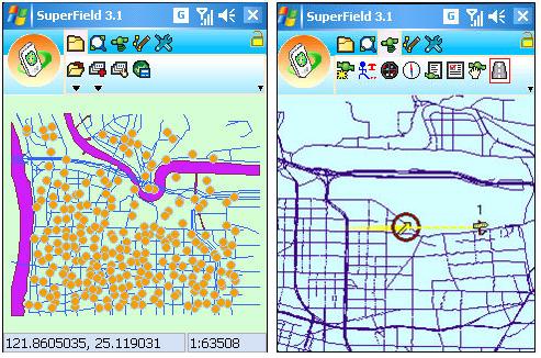
SuperField 3.1, the lightweight, task-oriented mobile GIS software, developed by SuperGeo is officially launched worldwide.
SuperField 3.1 and SuperPad 3.1 are both mobile GIS applications. SuperField 3.1 is designed for lightweight field-workers who require basic GIS functions to accomplish field investigation effectively. On the other hand, SuperPad is the full-function GIS software which contains diverse GIS tools and functions and enables users to synchronize survey data and spatial database through the Internet.
For users who require basic GIS tools and data collection, SuperField 3.1 is the very mobile GIS application which can assist users in completing field task such as adding, editing, querying spatial data, etc, in a economical and easy way.
SuperField 3.1 has an easy and friendly user interface that supports multiple languages such as traditional Chinese, Chinese, English, French, German, Arabic, Portuguese, Spanish, Italian, Japanese, Korean, Polish, Russian, and Turkish. Therefore, Users whose first language is not English can also complete field task efficiently and precisely via this friendly manipulating environment.
In addition, with flexible customizing functions, SuperField 3.1 can be customized to fit users’ need in various projects. Besides the existing functions, SuperField 3.1 can be developed with varied GIS functions like GPS, mapping and so forth.
To know more about our product and download the free trial, please get on our website: http://www.supergeotek.com/, or contact with us by e-mail: staff@supergeotek.com.