|
||||||
| Goals | ||||||
|
Department of Tourism of Providence University aims to integrate plentiful Seediq cultural information into tourism guide system through GIS. Thus, with the prevalence of smart phones, the tourism guide system is expected to be designed as an application on smart phones. Tourists who enter the tribal area will be able to know the traditional culture, natural resources and other precious information of Seediq via manipulating the tourism guide system which is installed in their smart phones. |
||||||
| Solutions | ||||||
|
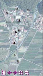
Department of Tourism of Providence University aims to integrate plentiful Seediq cultural information into tourism guide system through GIS. Thus, with the prevalence of smart phones, the tourism guide system is expected to be designed as an application on smart phones. Tourists who enter the tribal area will be able to know the traditional culture, natural resources and other precious information of Seediq via manipulating the tourism guide system which is installed in their smart phones. The four stages of building “The Seediq Tribe Tourism Guide System” include pre-procedure, system building, system modification, and system accomplishment. 1. The Pre-procedure: As field surveyors, students from Department of Tourism of Providence University went visit the tribe to collect historical and cultural information of the Seediq, and also recorded the tribal area spotting with GPS devices. After that, they converted the spotting data into vector data (GEO format) via SuperGIS DataConvetor 3, and utilized SuperGIS Desktop 3 to draw layers and rectify the images. 2. System Building: At this stage, students classified the diverse data, named the files according to its formats such as KML, PHOTO, VOICE, TXT and so forth, utilized SuperGIS Desktop 3 to manage data, built attribute table of layers and saved them as a project. And then, the project was converted into SuperGIS Mobile Tour Manager, the manage tool of mobile guide system, to facilitate setting of attractions, maps, and itinerary arrangement. The accomplished SMT project and related data would be copied to mobile devices afterwards. |
||||||
|
||||||
|
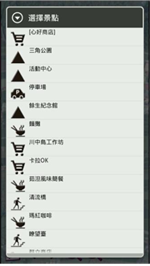
3. System Modification: Students entered tribal area with mobile devices to manipulate “The Seediq Tribe Tourism Guide System” there, and rearranged the itinerary according to recommendation from the Seediq people. The newly arranged the itineraries include the themes such as “Worships”, “Traditional Crafts”, “Natural Resource” and “Tour Attractions.” 4. System Accomplishment: To accomplish “The Seediq Tribe Tourism Guide System”, the four itinerary themes are integrated in one file. The adjusted project and data would also be copied and saved in the mobile devices afterwards. |
||||||
| Results | ||||||
|
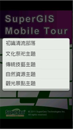
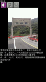
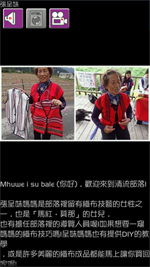
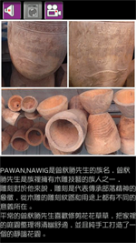
“The Seediq Tribe Tourism Guide System” not only integrates information of the Seediq tradition, history and culture but also transforms static information into multi-media type. It enables tourists to know plentiful Seediq culture promptly with mobile devices and “The Seediq Tribe Tourism Guide System” during visiting the tribal area. The four tourism themes of “The Seediq Tribe Tourism Guide System” are “Worships”, “Traditional Crafts”, “Natural Resource” and “Tour Attractions.” Static geographic information is transformed into dynamic tour guide. Moreover, on the way of visiting the Seediq tribe, tourists are able to watch a welcome video demonstrated by the Seediq people who introduce the tribe in their native language. The video also combines with photos of local attractions, thorough text and vocal introduction of attractions to offer tourists a complete and instant guidance. Therefore, tourists are able to gain information about Seediq culture and history with ease via introduction in multi-media type which is played automatically by system while approaching a certain attraction in the tribal area. |
||||||
|
||||||
|
For the Seediq tribe, “The Seediq Tribe Tourism Guide System” can not only benefit tourists with its plentiful guidance but also keep and pass the diverse traditions and resources of tribe from generation to generation. |