Tasmania has set the benchmark for responsible water management in Australia with radical landmark partnerships between the state’s three water authorities and the nation’s leading Geographic Information System (GIS) specialists, Esri Australia.
Each of the Apple Isle’s three providers – Ben Lomond Water, Cradle Mountain Water and Southern Water – have transformed their asset management systems with Esri Australia’s cutting-edge data mapping technology, making Tasmania the first Australian state to completely incorporate GIS throughout its water and sewage services.
The new systems are expected to deliver more reliable, safe and cost-efficient water services to 380,000 customers across the state.
Esri Australia Business Manager for Tasmania Jean-Noel Jarnet said the services had set a new national standard for water authorities across the nation.
“While other utilities currently use GIS to manage specific tasks, Tasmania’s progressive water authorities are the first set of providers in an Australian state to adopt the technology on an enterprise-wide scale,” Mr Jarnet said.
“It’s a visionary, two-year project that will revolutionise the way water and sewage services are delivered across Tasmania.
“By visually representing their data on a user-friendly map, the water authorities will have a clear picture of their operations and be able to identify where efficiencies could be improved – it’s location intelligence at its best.
“Ultimately, the real benefit will sit with the people of Tasmania, who will see an improvement in customer service and water delivery.”
Ben Lomond Water Executive Manager of Assets Ben Donohue said they now have a central mapping system that brings together a range of data essential to the company’s operations.
“Through the user-friendly interface we have a dynamic visual display of our customer location data, the locations of sewage and water assets, and other important information about company infrastructure,” said Mr Donohue.
“We have multiple types of assets – water pipes, sewer pipes, treatment plants, pump stations, valves – that can all be layered over a map using the GIS.
“This gives our staff fast access to maintenance information and incidents, allowing us to respond more rapidly and accurately to leaking pipes, service outages, and other issues.
“Customer service representatives also have access to the system, allowing them to give more accurate information to our customers.
“This kind of full-circle integration means we have one source of accurate data shared among our whole operation – ensuring there are no isolated pockets of the company.”
Mr Donohue used the reporting of a water-pipe leak as an example of the improved customer service and efficiency that would be delivered.
“If a customer calls and reports that they’re not receiving water, we can use the mapping system to zoom in on their property and see exactly what infrastructure is located there,” Mr Donohue said.
“With more than 1,800 kilometres of pipes across our service area, this ability is crucial.
“We can then make an assessment on what other customers or assets may be affected, and our customer service teams can notify them of any impending disruptions to their supply.
“Our maintenance teams can also use the same information to identify the quickest and safest way to access the assets, when to access them, and ultimately how to resolve the problem efficiently.”
Mr Donohue said that another advantage of the new GIS was that it integrated seamlessly with Ben Lomond’s existing systems.
“Certainly one of the greatest benefits is the GIS’s functionality with our existing record-keeping and correspondence systems,” Mr Donohue said.
“By integrating all our systems with Esri Australia’s technology, we can take further advantage of our existing resources to deliver a better service to our customers.
“It’s a truly transformative system and we are proud to set the benchmark for other water utilities around the nation with this progressive location intelligence solution.”
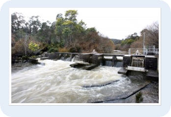
Tasmania is the first state to have its water wholly delivered using cutting-edge mapping systems.