GIS user technology news

News, Business, AI, Technology, IOS, Android, Google, Mobile, GIS, Crypto Currency, Economics

  • Advertising & Sponsored Posts
    • Advertising & Sponsored Posts
    • Submit Press
  • PRESS
    • Submit PR
    • Top Press
    • Business
    • Software
    • Hardware
    • UAV News
    • Mobile Technology
  • FEATURES
    • Around the Web
    • Social Media Features
    • EXPERTS & Guests
    • Tips
    • Infographics
  • Blog
  • Events
  • Shop
  • Tradepubs
  • CAREERS
You are here: Home / News / Developer Tools, Programs, Competitions / Intergraph and DigitalGlobe offer a geospatial challenge

Intergraph and DigitalGlobe offer a geospatial challenge

December 2, 2011 By Editor

An interesting competition being offered up to the ERDAS user community from Intergraph and DigitalGlobe. 

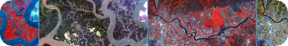
The competition challenges the user community to exploit tools from ERDAS and imagery from DigitalGlobe. Enter the challenge to get free imagery for your study and a chance to win five WorldView-2 scenes of your choice. In addition,  three finalists will be sent to present at ASPRS in Sacramento, CA on March 21-23, 2012. Entries will be accepted until December 12. DigitalGlobe will make 8-band imagery available to qualifying contestants to exploit WorldView-2 imagery using ERDAS IMAGINE for:

  • Spatial Modeling and Analysis
  • Image Visualization
  • Image Processing
  • Stereo Compilation and Elevation Modeling
  • Image Analysis
  • Feature Extraction

For those seeking a little extra help on this topic, ERDAS will be hosting a free webinar on Automated Feature Extraction with DigitalGlobe’s WorldView-2 Data – the webinar will take place online on December 7, 2011 and December 8, 2011.

See more details HERE


Filed Under: Developer Tools, Programs, Competitions Tagged With: Competitions, Developer Tools, Intergraph and DigitalGlobe offer a geospatial challenge, News, Programs

Editor’s Picks

JavaScript: Best Practice

JavaScript: Best Practices

10 Years of Images from ESRIUC and An All-Time Favorite Pic #esriuc

Mapping Water Use: Landsat and America’s Water Resources

NASA, NOAA Find 2014 Warmest Year in Modern Record

See More Editor's Picks...

About Editor

Glenn is a geographer and a GIS professional with over 20 years experience in the industry. He's the co-founder of GISuser and several other technology web publications.

Recent Industry News

Best Equipment Labels for Industrial Use: Ranked Systems That Survive Real-World Conditions

April 17, 2026 By GISuser

Building a Global Natural Brand: The Digital Journey of VedaOils

April 15, 2026 By GISuser

DeltaQuad partners with Meridein Group OÜ to strengthen UAS capability in the Baltics

April 15, 2026 By GISuser

The Complete Guide to Improving Home Safety and Efficiency with Dryer Vent Cleaning

April 12, 2026 By GISuser

Hot News

State of Data Science Report – AI and Open Source at Work

HERE and AWS Collaborate on New HERE AI Mapping Solutions

Virtual Surveyor Adds Productivity Tools to Mid-Level Smart Drone Surveying Software Plan

Categories

Copyright gletham Communications 2015 - 2026

Go to mobile version