Thanks to Joseph for this, his first GISuser "Expert" contribution! People have always been fascinated with investigating their home—the Earth. To understand our planet, ancient scholars in Rome, Greece, and China founded the study of geography over 2,500 years ago.
Today, geography is more relevant than ever before, as issues of climate change, economic globalization, urban sprawl, biodiversity loss, sustainable agriculture, water quality and quantity, crime, cultural diversity, energy, tourism, political instability, and natural hazards grow in importance on a global scale but also increasingly affect our everyday lives. To grapple with these issues requires a populace that has a firm foundation in geography, a populace that can see the “big picture” but also that understands how different patterns and trends are related from a global scale down to the local community. Geography is concerned with all of the relevant issues of our time, because all of these issues have a geographic component.
For centuries, maps have stirred imaginations and inspired explorations of the unknown. Today, maps are used to help understand relationships across areas and regions. These spatial relationships are analyzed using maps in digital form within a Geographic Information Systems (GIS) framework. In a GIS framework, rather than as static documents, these maps are dynamic. They can be grappled with and combined with other maps and data sets, as well as charts, databases, and multimedia. GIS, together with Remote Sensing and Global Positioning Systems (GPS), make up the geotechnologies, which help people make everyday decisions and plans more effectively and efficiently.
In education, GIS offers a powerful decision-making toolkit that can be used in educational administration, educational policy, and in instruction. GIS offers administrators a way to visualize and manage everything from monitoring campus safety, mapping campus buildings, cable, and other infrastructure, routing school buses, planning where and when to close schools and open new ones, and strategizing recruitment efforts. GIS provides educational policymakers with tools to see patterns in educational achievement and where to target new programs. In instruction, GIS in the hands of students helps them to understand content in a variety of disciplines, not only in geography, but in history, mathematics, language arts, environmental studies, chemistry, biology, civics, and many more. GIS is used as an inquiry-driven, problem-solving, standards-based set of tasks that incorporates fieldwork and provides career pathways that are increasingly in demand. It helps students think critically, use real data, and connects them to their own community. It does so in informal, primary, secondary, and university settings and appeals to today’s visual learners. Geotechnologies, along with biotechnologies and nanotechnologies, are the three key skills and job markets identified by the US Department of Labor for the 21st Century (Gewin 2004).
What is the relationship between birth rate and life expectancy? Why does this relationship exist? How does acid mine drainage in a mountain range affect water quality downstream? How will climate change affect global food production? With GIS, students explore the relationships between people, climate, land use, vegetation, river systems, aquifers, landforms, soils, natural hazards, and much more. With the flood of information available to students today, they need to be able to deal with uncertainty about data, to understand its limitations with regards to error and omissions, and to effectively manage it. GIS is a tool that provides holistic computer and management skills for students, a part of a geospatial technology competency model recognized by the US Department of Labor (2010) that includes computer, personal, and organizational competencies.
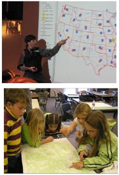 Using GIS provides a way of exploring not only a body of content knowledge, but provides a way of thinking about the world (Bednarz 2004; Kerski 2008). These skills were identified as essential to K-12 education by the National Academy of Sciences (2006). The geographic perspective informs other disciplines. When epidemiologists study the spread of diseases, scientists study climate change, or businesspersons determine where to locate a new retail establishment, they use spatial analysis. In each case, GIS provides critical tools for studying these issues and for solving very real problems on a daily basis.
GIS in instruction also incorporates and depends upon fieldwork, which is critically needed for understanding and appreciating our world (Louv 2006). Students can gather locations with GPS and attribute information about tree species, historical buildings, water quality, and other variables on a field trip or even on their own school or university campus.
GIS-based questions begin with the “whys of where”—why are cities, ecoregions, and earthquakes located where they are, and how are they affected by their proximity to nearby things and by invisible global interconnections and networks? After asking geographic questions, students acquire geographic resources and collect data. They analyze geographic data and discover relationships across time and space.
Geographic investigations are often value-laden and involve critical thinking skills. For example, students investigate the relationship between altitude, latitude, climate, and cotton production. After discovering that much cotton is grown in dry regions that must be irrigated, they can ask “Should cotton be grown in these areas? Is this the best use of water and other natural resources?” GIS helps students to act on their investigations, to put their recommendations in place, to improve the quality of lives of people and the health of the planet. Students present the results of their investigations using GIS and multimedia. Their investigations usually spark additional questions, and the resulting cycle is the essence of geographic inquiry.
References
- Bednarz, S. 2004. GIS: A tool to support geography and environmental education? GeoJournal 60(2): 191-199.
- Gewin, V. 2004. Mapping opportunities. Nature 427: 376-377. 22 January.
- Kerski, J. 2008. The role of GIS in digital earth education. International Journal of Digital Earth. 1(1): 326-346.
- Louv, R. 2005. Last Child In the Woods. Algonquin Books.
- National Academy of Sciences. 2006. Learning to Think Spatially: GIS as a Decision-Support System in the K-12 Curriculum. National Academies Press.
- US Department of Labor. 2010. Geospatial technology competency model.
Joseph Kerski, Geographer, has a background in government, academia, and industry. He serves as Education Manager for Environmental Systems Research Institute (Esri) in Colorado, USA. He served for 21 years as Geographer at the US Geological Survey and at the US Census Bureau. Follow Joseph on Twitter @josephkerski
For more articles that touch on the topic of GIS in Education see HERE
See also Downloading and Formatting Topographic Maps and Aerial Photographs from Terraserver from Joseph Kerski