Visitors to Booth #2530 at the International ESRI User Conference will have a chance to visit with the Berkeley, CA-based earthmine team
During the ESRI User Conference, earthmine will unveil its new ArcGIS add-in for ArcMap, providing a powerful way to visualize map data in context and easily populate a geodatabase through a point-and-click interface. earthmine for ArcGIS integrates detailed, immersive, spatially accurate 3D imagery of streetscapes and pedestrian areas – ranging from a few blocks to an entire country. The new product joins a suite of products and solutions designed as a complete, end-to-end process for collecting 3D street level imagery, developing applications and delivering visually impressive and spatially accurate results for any application.
This powerful addition to the earthmine software suite provides seamless integration into ESRI’s ArcGIS Desktop product . Its dockable window displays a high resolution, immersive street level view alongside the traditional map view. Features within a geodatabase are accurately displayed on top of the panoramic imagery, providing both a powerful way to visualize spatial data within its real world context, while also capable of gathering additional information that may not be contained within your GIS. The entire solution can be seen at earthmine’s booth #2530. Anthony Fassero, co-founder and co-CEO of earthmine will be presenting a session on earthmine Products and Solutions on Tuesday, July 13 from 12-1 pm in B2/C Exhibit Hall. Additionally, he will be discussing earthmine case studies on Wednesday, July 14 from 10-11am in the B2/CExhibit Hall.
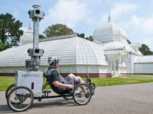
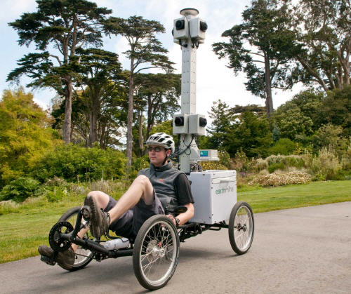
About the earthmine solutions (earthmine.com)
earthmine for ArcGIS is the perfect backdrop for mapping fine detailed assets, and contains a full set of measurement tools to accurately measure distances and calculate areas. The add-in works seamlessly with earthmine’s existing product line, and is up and running in minutes. Users can connect to data hosted on their own earthmine Server installation, or connect to remotely hosted data as part of the earthmine Cloud service. Most recently, earthmine announced a partnership with France’s PagesJaunes Groupe, using the Berkeley-based 3D street mapping company for a major new urban community Internet platform. Through earthmine technology, PagesJaunes’ UrbanDive will enable users to navigate in French cities via immersive, panoramic views and interact with and share data with a community of users. Through a strategic partnership with PagesJaunes, earthmine is collecting 3D street-level urban imagery and rich geo-spatial data in 50 major French cities, and providing the software platform to launch the company’s new major online mapping service.
Related Articles and weblinks:
- Geo Web Pioneer Brings Over 25 Years of Mapping Industry Experience to Earthmine
- Earthmine Wins Coveted Crunchies Award – Company Named Best Technology Innovation/Achievement
- earthmine Unveils Urban 3D Mapping Technology for Web-Based Geospatial Applications
An overview of the application can be seen here: