
After 12 years of discussion, development, review, and testing, the resulting SDTS was approved as Federal Information Processing Standard (FIPS) 173, and now also as FGDC-STD 002. Compliance with SDTS, also known as FIPS 173, is now mandatory for all federal agencies.SDTS is a transfer standard that embraces the idea of self-contained transfers; spatial data, attributes, georeferencing, a data quality report, a data dictionary, and other supporting metadata are all included in the transfer.
Two digital cartographic products of the U.S. Geological Survey (USGS), Digital Line Graphs (DLG) and Digital Elevation Models (DEM), are available in the Spatial Data Transfer Standard (SDTS) format.The USGS distributes these data sets over the Internet as a means of promoting the standard.The SDTS is an ANSI approved data exchange standard that has been mandated for federal use. Numerous software packages from vendors such as ESRI, Integraph and ERDAS are able to accept data in this format.
This document (see below) is a detailed explanation of procedures for downloading and unpacking USGS SDTS data. DLG data sets were created by reformatting digital line graph optional (DLG-O) data as SDTS.DEM data sets were created by reformatting existing data sets to the SDTS format.These conversions include adding metadata to each transfer, but do not necessarily include any update or other content changes to the spatial data.
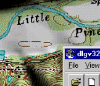
The document can be used as a companion to DLGv32 Pro, a free USGS Digital Data Viewer. See also http://mcmcweb.er.usgs.gov/drc/dlgv32pro/ for additional information about DLGv32 Pro. The procedures described here also may be beneficial to users of other software.
To access the tutorial see:
- http://thor-f5.er.usgs.gov/sdts/articles/word/SDTS.Tutorial.2003.doc
- http://thor-f5.er.usgs.gov/sdts/articles/ascii/sdts_tutorial.txt
USGS SDTS data are a reflection of USGS native data. For more information on USGS digital data, visit http://edc.usgs.gov.