| |
 |
|
Maptiks Launches Mapping Analytics Tool
Maptiks is like Google Analytics for your web map and currently integrates with Google Maps API, OpenLayers3 and LeafletJS. Soon it will also support Mapbox.js, ESRI javaScript API, CartoDB.js, and Bing Maps.
|
|
| |
 |
|
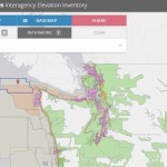
Data Tip - The US Interagency Elevation Inventory
The USGS liaisons are updating the United States Interagency Elevation Inventory. This resource also provides a wealth of information and data. This web service provides users with access to data including: topo LiDAR, shoreline data, bathymetric LiDAR, hydrographic surveys and much more
|
|
| |
 |
|
TerraGo to Showcase Collaborative Geospatial Solutions at INTERGEO 2015
TerraGo, a pioneer of geospatial collaboration and mobility software, will exhibit at INTERGEO 2015, which takes place September 15th - 17th in Stuttgart, Germany.INTERGEO is the industry's largest conference and enables dialogue with leading geospatial technology providers and users from around the world
|
|
| |
 |
|
HOT GeoJob! Cartographer/GIS Developer
This work includes developing the design criteria, specifications, quality standards, and workflows for all cartographic products as well as the production of those products. The successful candidate will be well-versed in cartographic design as well as the development and implementation of cartographic production workflows using ESRI ArcGIS
|
|
|
|







