| |  | |
Drones over German cities – science fiction or future market?
Against the backdrop of the German Federal Government’s funding programme for drones and air taxis, together with the unveiling of the CityAirbus in Ingolstadt in March, industry experts recently gathered in Berlin for a Round Table meeting. At the invitation of Europe’s largest drones trade fair, INTERAERIAL SOLUTIONS part of INTERGEO...
|
|
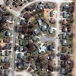
| |  | | Virtual Surveyor Unveils Terrain Lenses in Drone Mapping Software
Virtual Surveyor has unveiled Terrain Lenses in Version 6.3 of its popular drone surveying and mapping software. Overlaid on a LiDAR point cloud or orthophoto, the six lenses enhance different aspects of the terrain in 3D to give users a better understanding of the topography in the area they mapped with an unmanned aerial vehicle (UAV).
| |
| |