GIS user technology news

News, Business, AI, Technology, IOS, Android, Google, Mobile, GIS, Crypto Currency, Economics

  • Advertising & Sponsored Posts
    • Advertising & Sponsored Posts
    • Submit Press
  • PRESS
    • Submit PR
    • Top Press
    • Business
    • Software
    • Hardware
    • UAV News
    • Mobile Technology
  • FEATURES
    • Around the Web
    • Social Media Features
    • EXPERTS & Guests
    • Tips
    • Infographics
  • Blog
  • Events
  • Shop
  • Tradepubs
  • CAREERS
You are here: Home / * PRESS / Business / Telespazio Group, with GAF and e-GEOS as the implementing companies, awarded Framework Contract for the Validation of Innovative Geospatial Tools: LOT 1 – S

Telespazio Group, with GAF and e-GEOS as the implementing companies, awarded Framework Contract for the Validation of Innovative Geospatial Tools: LOT 1 – S

December 21, 2018 By GISuser

GAF AG, together with e-GEOS, has been awarded a Framework Contract by the European Union Satellite Centre for the provision of satellite-based digital elevation models to support the validation of innovative geospatial tools for SatCen’s exploitation activities.
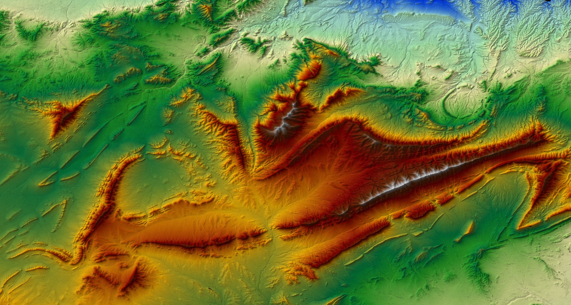
These digital elevation models have a resolution of between 0.5 m and 10 m and are generated using a highly automated multi-source production line. Additionally, the products are delivered with different quality- and traceability layers, and the corresponding metadata are adapted to the user’s requirements.

For nearly 20 years, GAF has been providing different institutional and private customers worldwide with various types of high quality digital surface models (DSMs), digital terrain models (DTMs) and other elevation products, mainly derived from optical (multi-) stereo satellite data. During the last 10 years, GAF has generated a multitude of very-high and high resolution digital elevation models (GAF Elevation Suite) for a total area of more than 7.7 million km² worldwide.

e-GEOS has longstanding experience with SAR satellite data processing, including the production of digital surface models (DSMs) from SAR images using both, interferometric and radargrammetric techniques.

The Framework Contract will run until the end of 2018, with the potential to be extended for another year.

About GAF AG

GAF AG is an e-GEOS (Telespazio/ASI) company based in Munich, Germany. It is a leading solutions provider with an international reputation as a skilled and reliable supplier of data, products and services in the fields of geo-information, satellite remote sensing, spatial IT and consulting for private and public clients. During the last three years, GAF has generated more than half of its revenues from defence and security customers. GAF also provides solutions in the sectors of agriculture and food production, environmental and water resources management, forestry and climate change, infrastructure and mobility, land management, insurance and asset management, mining, oil and gas, telecommunications and network planning, and space agencies and satellite operators. Since 1985, GAF AG has successfully completed more than 1,000 projects in 144 countries. Further information is available at http://www.gaf.de.

About e-GEOS

e-GEOS, an ASI (20%)/Telespazio (80%) company, is a leading international player in the Earth Observation and Geo-Spatial Information business. e-GEOS offers a unique portfolio of application services, also thanks to the superior monitoring capabilities of the COSMO-SkyMed constellation, and has acquired a leading position within the European Copernicus Program. Application services include: monitoring for environmental protection, rush mapping in support to natural disaster management, specialized products for defence and intelligence, oil spill and ship detection for maritime surveillance, interferometric measurements for landslides and ground subsidence analysis, thematic mapping for agriculture and forestry. In support to its operational applications, e-GEOS operates the Matera Space Centre for acquisition, archiving and processing of multi-mission satellite data including COSMO-SkyMed and ESA Sentinels. Further information is available at www.e-geos.it.

Filed Under: Business

Top Press

The Global Expansion of Aueshah: A New Era of High Jewelry

April 11, 2026 By GISuser

KARACHI, PAKISTAN. The international luxury market is experiencing a profound shift. Consumers are increasingly rejecting mass-produced goods in favor of rarity, authenticity, and emotional depth. … [Read More...]

State of Data Science Report – AI and Open Source at Work

September 10, 2025 By GISuser

AI and Open Source at Work … [Read More...]

Topcon Announces Landmark Expansion of Topnet Live Network Across USA

January 26, 2025 By GISuser

LIVERMORE, Calif.---Topcon Positioning Systems has announced a significant expansion of its Topnet Live reference station network, introducing 200 new geodetic stations strategically positioned across … [Read More...]

Space Flight Laboratory (SFL) Announces Launch and Deployment of NorSat-4 Maritime Monitoring Microsatellite

January 19, 2025 By GISuser

Seventh Satellite Developed by SFL for Norway … [Read More...]

HERE and BMW Group extend partnership on AI-powered mapping system

January 8, 2025 By GISuser

HERE and BMW Group extend partnership on AI-powered mapping system for automated driving and enhanced road safety … [Read More...]

Everest Base Camp Helicopter Tour, Helicopter Return Trek, and Manaslu Circuit Trek: Which Nepal Adventure Is Right for You?

November 6, 2026 By GISuser

Almost everyone planning a Nepal trip runs into the same wall. You want the big mountains, you have a fixed number of days, and every itinerary you read seems to promise something … [Read More...]

SFL Missions Inc. Confirms Successful Deployment of Six HawkEye 360 Radio Frequency Detection Satellites with Advanced Capabilities

October 27, 2026 By GISuser

MĀHIA, New Zealand, 26 October 2026 – SFL Missions Inc. today confirmed the successful deployment of six radio frequency (RF) detection and geolocation satellites for HawkEye 360 … [Read More...]

Canadian-Built RoadEng 12 Uses AI to Find the Best Location for New Resource and Rural Roads

October 17, 2026 By GISuser

Vancouver, BC, Canada, October 15, 2026 – North Vancouver-based Softree Technical Systems today released RoadEng Version 12, used in more than 75 countries to locate and design … [Read More...]

Beyond the Map: How AI Image and Video Generation Is Changing Geospatial Communication

October 14, 2026 By GISuser

Ask anyone who has shipped a GIS project what the hardest part was, and the answer is rarely the spatial analysis. It is almost always the communication. A site suitability … [Read More...]

From Maternity to Everyday Wear: Building a Wardrobe That Grows With You

October 14, 2026 By GISuser

When I think about maternity clothing, I feel the biggest mistake is buying too many things at once. During pregnancy, your body keeps changing, and something that fits well today … [Read More...]

Copyright gletham Communications 2015 - 2026

Go to mobile version