Small scale applications of 3D images have been around for quite some time. For example, 3D X-ray imaging shows in full color precise details of what’s inside your body, helping doctors diagnose conditions and determine areas of concern prior to surgery.
In Shanghai, China, workers constructed a 3D printed concrete bridge at about two-thirds the average cost. Biologists are using 3D robotic vision systems to measure plants’ characteristics and physiological properties faster and more accurately than existing 2-D systems. Even in the consumer world, 3D imaging captured our attention with the creation of 3D TVs, but that market has mostly been abandoned.
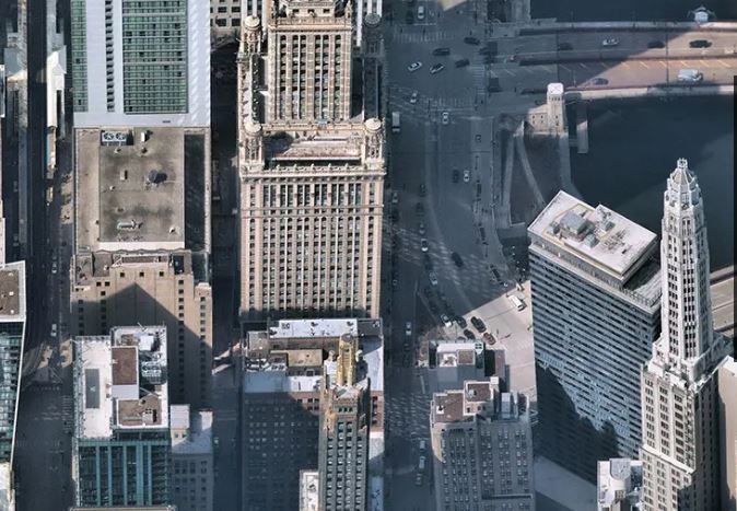
Today, 3D imagery is emerging in more large-scale projects. Using powerful camera systems and sophisticated processing software, aerial and satellite imagery companies are capturing large areas in high-resolution 3D photos. Even though these images are generating a massive amount of data, software systems can condense these images and stream them to desktops or mobile devices from the cloud.
With immersive 3D mapping content, you can see specific details of your city or area. Not only can you see the front of a building or area, but you can look at the back and sides, virtually “flying” through an image, rotating views in all cardinal directions and looking up or down to see details you can’t see in just a two-dimensional photo.
Images captured by these companies are taken at regular intervals, documenting updates of changes in an area, and providing a historical 3D record of each location.
Because of these advances, 3D mapping content now has large scale potential applications for use in numerous industries. Here are a few examples of the future power of 3D maps.
Social media
Much of the social media experience consists of taking selfies/videos in front of landscapes and locations. Imagine visiting the Eiffel Tower, and when you take a selfie/video in front of it, your social media platform recognizes the location and offers to insert a 3D background (static or animated) of that location instead. With that 3D digital twin model, you could maneuver the background to the perfect angle to match your selfie, or you could even use some creativity to make a cool immersive video of your experience.
AR/VR
AR/VR ignited the imaginations of users, developers and analysts with the launch of the Pokémon GO app in 2016. Today there are numerous ways to use AR/VR—and it’s for more than games. Some applications allow you to create 3D works of art, explore our world above the ground or in the water, or even making digital shopping easy by showing you what a dining table will look like in your kitchen—in exact scale. In order to make AR/VR a reality, there’s a fundamental requirement to model the reality around us in a streamable digital format. For example, if an AR/VR travel application aims to provide a user with the experience of visiting New York City’s Times Square or a world heritage site virtually, there is an inherent requirement to have detailed 3D models of these sites. With 3D mapping content, developers don’t have to create cityscapes from scratch. They can use actual multi-perspective images from content of aerial imagery providers to create photo-realistic and immersive digital twins. The developer’s AR/VR content can overlay a detailed map, creating a persistent, immersive and cohesive experience.
Automotive applications and autonomous driving
Many of us can spend a significant amount of our day driving—to and from work, school, errands, etc. Because it’s based on geolocation data, 3D imagery can help automotive applications work better. With the geo-referenced 3D map as a reliable backbone, the interplay of the live data flowing in from various connected devices like Dashcams, car-sensors, navigation systems can be streamlined to make better, faster and optimized decisions.
Also, autonomous cars can save processing power to determine the environment around them. Instead of using sensors to detect stationary objects, car manufacturers can load existing 3D imagery into the car sensor system. That way, the car’s processing system will already know the stable environment in an area—items such as trees, curbs, buildings, sidewalks, etc. The car systems can then use processing power and sensors to detect movable, non-stationary objects such as pedestrians, other cars and other potential obstacles, speeding up the reaction time of the car’s system.
GPS Shadow modeling
While GPS tracking on your phone works well in most places, it struggles to be accurate in large cities with lots of tall buildings. The accuracy of the GPS-derived location is greatly compromised in urban-canyons/downtown areas as the threshold number of GPS satellites do not have a direct line of sight to your position or the GPS signal can bounce off those tall buildings and misplace your location as much as 100 yards. Some ride sharing services have been canceled because the driver’s and the rider’s GPS transmit miscommunicated live locations causing confusion, chaos and ultimately cancelled rides.
High-resolution 3D aerial maps solve this problem because accurate 3D models of the Urban canyons combined with AI models can help to screen out the satellites that cannot be reliably used to derive consumer location. GPS programs can then anticipate location problem areas and match the GPS signal with the best satellite to mark your location more accurately. It’s called GPS shadow modeling. Various big-tech companies are already working on this problem. Accurate 3D maps could help locate the users (people and machines) more precisely in an urban environment and reduce canceled rides, keep automated cars in lanes and help mitigate other problems associated with GPS errors in large cities.
Even though low-resolution and/or low-scale 3D maps have been around for a while, high-resolution 3D aerial maps is at an inflection point, where it can be used in many more industries and many more applications than currently in use. Watch for exciting new applications that will help both businesses and consumers at scale in the coming years.
Author / Credit
By Sanchit Agarwal, vice president, technology, international partnerships & expansion, Nearmap