(via the USGS) Flood Preparedness – There’s a New USGS Map (or App) for That — An innovative Twitter feed and map provide real-time water, weather and flood forecasting for Texas.
During the recent Texas flooding, the U.S. Geological Survey unveiled a new tool that gives users real-time water, weather and National Weather Service flood forecast information all in one place. When water levels are rising, it can be hard to quickly get all the information you need about your area, especially when you’re not in front of a computer.
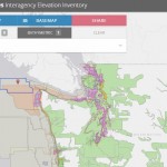
The new USGS Texas Water Dashboard is a cutting-edge map that provides critical current water information and NWS forecast data at your fingertips on a desktop, smartphone or other mobile device. This is a first-generation product that brings real-time USGS data together in a web mashup with information from the NWS and other sources. The USGS will explore the potential value of this product to the public, and could possibly expand its reach to include the rest of the nation in the future.
Now, you don’t have to search multiple sources when you want the latest information on floods and droughts, or when you’re just deciding your next recreation destination. The Texas Water Dashboard presents USGS real-time stream, lake and reservoir, precipitation and groundwater data for more than 750 USGS real-time observation stations in Texas. This USGS information is shown along with weather data such as radar, past precipitation totals, precipitation forecasts and drought conditions from other sources.
“The Texas Water Dashboard provides a user-friendly ‘one-stop’ picture that is of extreme use to water resource managers, with the simplicity to be used by the general public,” said Mark Null, National Weather Service Hydrologist-In-Charge, West Gulf Coast River Forecast Center.
When the Power is Out, Social Media Can Be a Lifeline
During the 2015 flooding in Texas, many people throughout the state were without power and relied on social media to get the latest information about current water conditions. It became clear to the USGS Texas Water Science Center that it should explore additional opportunities for distributing water data using social media and mobile platforms.

With the help of Twitter, two new fully-autonomous feeds were developed to distribute water level and precipitation data: USGS TX FloodWatch (@USGS_TexasFlood) and USGS TX RainWatch (@USGS_TexasRain). The FloodWatch feed automatically sends out tweets anytime one of about 300 selected USGS streamgages throughout the state rises above the NWS-defined flood level, and delivers information within minutes. The RainWatch feed tweets when rainfall exceeds a rate of 0.4 inches per hour.
Useful for Cities, Outdoor Recreationalists, Landowners and More!
The Twitter feeds and Texas Water Dashboard can do more than assist residents during flooding. Understanding weather and streamflow can help determine the best places to go boating, fishing or hiking. It can also help recreationalists and landowners understand if stream levels are rising or falling at any given time.
Real-time groundwater levels can also be found on the map. This information could be useful for water managers in making informed decisions about local resources.

Personalizing TX Twitter Feed to Work for You!
The USGS Texas FloodWatch Twitter page was developed so that users can view streamgage sites that are relevant to them and create their own personalized Twitter feed. Users can also create a specific group of streamgages as a feed into their own webpage.
These capabilities could be useful for boaters who want to know the best time to run a specific stretch of river, or a homeowner’s association that wants to keep their neighborhood informed about water levels. Many other groups could find this feature useful, including cities, counties, farmers, landowners, hikers and emergency responders.
Take the Texas Water Dashboard Map for a Spin
Can you find places with increasing versus decreasing flow?
Here’s how you can search:

Statewide flow conditions can be explored with complimentary datasets such as weather radar and GOES satellite data from the Layers menu. Clicking on the Legend button will bring up information about the symbols used in the map. Black circles show streamgages in all-time high conditions, while magenta halos show sites currently in NWS-flood stage. Low-flow conditions are represented with orange and red circles, and sites that aren’t flowing have brown halos.
Does it look safe to raft the San Marcos River right now?
Here’s how you might find out:

The San Marcos River is a popular recreation destination for boating and tubing. The Texas Water Dashboard is a useful application to explore local streamflow conditions before heading out on your next float trip. Just click directly on the interested site to get the latest information. In this example, the streamflow is shown at 286 cubic feet per second. You can see it’s slightly higher than the median flow of 160 cubic feet per second for this day. From this view users can also see streamflow values of other local waterways at a glance.
Can you find areas that are experiencing no-flow or drought conditions? Look for the brown halo around each site.
Are any experiencing flood conditions? Look for the magenta halos or symbols that are black in color.

The Texas Water Dashboard allows you to observe a variety of conditions using a wide array of data layers. The Base Map button provides multiple options, including topography, imagery and hydrology maps. The Drought Monitor is a useful index to understand the impact of drought conditions on streamflow statewide or within individual basins. This image from April 21, 2016 shows areas in the Texas Panhandle and Trans-Pecos regions experiencing lower flows and slight drought conditions.
Can you find information about flood forecasts in Texas?

In addition to current conditions provided by USGS observation stations, the Texas Water Dashboard allows you to connect with valuable forecast information from the National Weather Service. Find a circle with a magenta halo around it. Clicking on this site will provide the latest information about the forecast river height at this location. The Twitter panel provides current conditions at USGS sites, as well as information from partner agencies and other crowd-sourced outlets.
Can you find the USGS station that tweeted information most recently?

You can see where the most recent change in streamflow or rainfall activity is occurring by zooming into the location from where the most recent tweets resulted. In the Location Search box, enter the location contained in the USGS station name listed in the tweet to zoom to that area. Or, enter the number that follows “USGS” in the hashtag to zoom to the USGS station.
What’s Your Source?
The Texas Water Dashboard uses data from the USGS National Water Information System (NWIS). The NWIS dataset includes information from more than 1.5 million sites, some in operation for more than 100 years. For more information visit the USGS NWIS website.
Sources of map information include: the National Weather Service, Iowa Environmental Mesonet, Interior Geospatial Emergency Management System, the DOI Office of Emergency Management, National Drought Mitigation Center at the University of Nebraska-Lincoln, the United States Department of Agriculture and the Iowa Environment Mesonet.
Source: USGS