| Scenario | |||||||||||||||||||||||||||||||||||||||||||||||||
|
|||||||||||||||||||||||||||||||||||||||||||||||||
| Goals | |||||||||||||||||||||||||||||||||||||||||||||||||
|
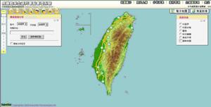
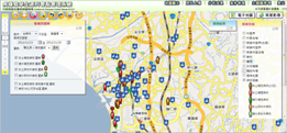
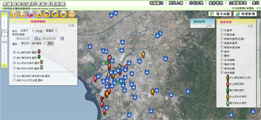
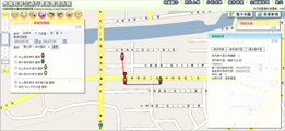
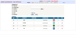
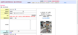
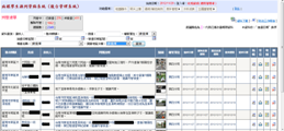
To assist epidemic control personnel in comprehending epidemic situation of dengue fever, CDC planned to build an epidemic situation management GIS system which enables epidemic control personnel to report dengue fever infection situation in each area after logging in the system. In addition, integrated with map display and diverse analysis functions, this system also allows users to comprehend mutual relations among dengue fever occurrence, locations and vector mosquito habitats. Thus, the system must equip with the database which can store information of the locations where dengue fever occurred and the infected patients, and the system also needs to have abilities to integrate with map information and analysis functions. Therefore, the epidemic control personnel is able to realize epidemic situation in every district by map browsing and then tell if cluster infection arises and clearly distinguish whether the dengue fever is primarily caused by to vector mosquito habitats. |
|||||||||||||||||||||||||||||||||||||||||||||||||
| Solutions | |||||||||||||||||||||||||||||||||||||||||||||||||
|
Epidemic Situation Management GIS website adopts SuperGIS Server 3 as GIS server software which is able to publish and manage map information. In addition to building map websites by utilizing SuperGIS Server 3, developers also can apply customization functions, Jquery and Javascript syntax to have their map websites demonstrate interactive visual effects and designed as required. Besides, Epidemic Situation Management GIS website adopts Microsoft SQL Server 2008 to store and manage relevant indices and statistic information. |
|||||||||||||||||||||||||||||||||||||||||||||||||
| Results | |||||||||||||||||||||||||||||||||||||||||||||||||
|
|||||||||||||||||||||||||||||||||||||||||||||||||
See http://www.supergeotek.com
See more stories – http://www.supergeotek.com/Library_GISApplication.aspx
